

The upcoming Independence Day weekend is shaping up to be a test of endurance for millions across the Mid-Atlantic and Southeast. As temperatures climb toward a dangerous 100°F—with heat indices potentially soaring as high as 115°F—a severe heat dome is set to blanket the region, threatening to turn outdoor celebrations into hazardous environments. For those planning to attend major events like the ‘America 250’ observances, the combination of extreme humidity and intense solar radiation makes heat safety not just a recommendation, but a necessity for survival.
Simultaneously, heightened awareness of the current Atlantic hurricane season has left many residents concerned about potential weather shifts. While the National Hurricane Center confirms that no tropical systems are currently posing an immediate threat to the July 4th holiday, the climate tension is palpable. This guide cuts through the noise to provide a survival roadmap, helping you balance your celebration plans with rigorous heat safety protocols while providing the clarity needed to keep your holiday weekend stress-free.
Understanding the July 4th Weather Convergence: Heat Domes and Atlantic Activity

The meteorological outlook for the Independence Day holiday is dominated by a powerful heat dome currently settling over the Mid-Atlantic and Southeast regions. A heat dome occurs when a persistent high-pressure system traps stagnant, hot air over a specific region, effectively acting as a lid on a pot. As this system intensifies, it compresses the air and prevents the arrival of cooler, moisture-laden air masses. For millions of Americans preparing for America 250 celebrations, this means temperatures will likely flirt with the 100°F mark. More critically, high humidity levels will push heat indices—the “feels-like” temperature—into the dangerous range of 110°F to 115°F, creating a significant risk for heat-related illnesses during outdoor festivities.
Navigating Tropical Wave Monitoring
While the heat represents an immediate, localized threat, social media discourse has also highlighted public concern regarding potential hurricane activity in the Atlantic. The National Hurricane Center (NHC) is currently tracking several tropical waves moving across the Atlantic basin, which is a standard procedure during the active hurricane season. However, it is essential to distinguish between routine meteorological monitoring and an active storm threat:
- Routine Monitoring: Meteorologists observe tropical waves throughout the season as part of standard data collection to identify potential development long before a system forms.
- Current Status: As of the latest updates, the NHC has indicated that no tropical cyclone development is expected that would impact the US mainland during the July 4th weekend.
- Transparency: Public anxiety regarding storm rumors often stems from misinterpreting satellite tracking maps. Current data confirms that the primary challenge for holiday travelers and event organizers remains the extreme heat, not tropical weather systems.
By maintaining awareness of these two distinct phenomena, citizens can better prepare for a safe holiday. Prioritize hydration and seek shade, and rely on official NHC updates rather than speculative social media reports to remain informed.
Staying Safe: Essential Tips for Outdoor July 4th Celebrations

As the july 4th atlantic weather forecast indicates a persistent heat dome across the Mid-Atlantic and Southeast, prioritizing safety during Independence Day festivities is non-negotiable. With heat indices projected to reach dangerous levels between 110°F and 115°F, attendees must take proactive measures to mitigate the risks of heat-related illnesses. The most effective strategy is to limit outdoor exposure during the peak heat window of 12:00 p.m. to 6:00 p.m. Whenever possible, shift your holiday schedule to take advantage of the cooler morning hours or plan post-sunset activities once the immediate solar intensity subsides.
Hydration and Heat Awareness
Aggressive hydration is your primary defense against extreme temperatures. Do not wait until you feel thirsty to drink water; consume fluids consistently throughout the day, and consider electrolyte-rich beverages to replenish salts lost through perspiration. Be vigilant for the warning signs of heat exhaustion, which include heavy sweating, cold or clammy skin, dizziness, and a rapid, weak pulse. If you experience these symptoms, move to a shaded area or an air-conditioned environment immediately. Many municipalities are establishing local cooling centers; check your city’s official website or emergency management portal to locate the nearest facility.
Protecting Vulnerable Populations
Children and pets are significantly more susceptible to heat-related stress because their bodies regulate temperature less efficiently than adults. Keep these essential safety tips in mind:
- Pet Precautions: If it is too hot for your hand to rest comfortably on the pavement for five seconds, it is too hot for a dog’s paws. Keep pets indoors or provide ample water and shade if they must be outside. Never leave a child or pet in a parked car, even for a few minutes, as interior temperatures can skyrocket to lethal levels in moments.
- Sun Safety: Wear lightweight, light-colored, and loose-fitting clothing. Apply high-SPF sunscreen every two hours, as sunburn significantly impairs the body’s ability to cool itself.
- Modified Attendance: For major events like ‘America 250’ celebrations, prioritize staying in areas with high canopy cover or temporary shade structures to minimize direct thermal radiation.
By staying informed about localized heat alerts and strictly following these safety protocols, you can enjoy the holiday without compromising your health or the well-being of your family.
Atlantic Hurricane Season: Myth vs. Fact

As we approach the Independence Day holiday, concerns regarding july 4th atlantic weather often conflate routine meteorological monitoring with immediate disaster threats. It is essential for the public to distinguish between active tropical storm development and standard seasonal observation. According to the National Hurricane Center (NHC), meteorologists are currently tracking several tropical waves across the Atlantic basin. However, data confirms that no tropical cyclone development is expected to impact the United States during the upcoming holiday period.
To help navigate this period of heightened awareness, consider these clarified facts:
Separating Meteorological Reality from Rumor
- Myth: Any tropical wave detected in the Atlantic is a precursor to an imminent hurricane hitting the U.S. coast.
- Fact: The Atlantic basin is vast, and tropical waves are common features of the summer climate. Most waves dissipate harmlessly over the open ocean, far from land, or encounter unfavorable atmospheric conditions—such as dry air or wind shear—that prevent development.
- Myth: Public agencies are “hiding” storm data to prevent holiday panic.
- Fact: The NHC maintains a transparent, data-driven reporting standard. If a threat were imminent, official watches and warnings would be issued via emergency broadcast systems immediately. Monitoring is a routine safety measure, not an indicator of an immediate crisis.
Prioritizing preparedness over panic is the most effective approach for any holiday weekend. While the current focus should remain on the extreme heat dome conditions affecting the Mid-Atlantic and Southeast, hurricane season awareness remains a best practice. Rather than relying on social media rumors, residents should monitor official NWS channels for the most accurate, science-backed updates regarding tropical activity. By staying informed, you can enjoy your festivities with peace of mind.
Regional Outlook: What to Expect in Major Mid-Atlantic and Southeast Cities

The July 4th Atlantic weather forecast is dominated by a persistent heat dome that is expected to create dangerous conditions across the Mid-Atlantic and Southeast. While meteorologists are monitoring the tropics, the immediate threat for holiday revelers is the extreme heat and humidity. Residents in major metropolitan corridors should prepare for temperatures consistently near or above 100°F, with heat indices—the “feels like” temperature—potentially reaching as high as 115°F in some inland valleys. This level of sustained thermal stress poses a significant health risk, particularly for those attending outdoor “America 250” celebrations, parades, and firework displays.
City-Specific Heat Expectations
As the high-pressure system anchors itself, the following regions are under heightened scrutiny for extreme heat alerts:
- Washington, D.C.: The capital is bracing for intense urban heat island effects. Temperatures are projected to hover in the upper 90s, with high humidity pushing heat indices to the 105°F–110°F range. Attendees of national celebrations are urged to seek shaded areas and utilize public cooling centers.
- Richmond, VA: Inland warmth will be persistent, with little overnight relief. Forecasts suggest peak afternoon temperatures near 98°F. The lack of significant cloud cover will maximize UV exposure.
- Raleigh, NC: The Research Triangle area will experience stifling humidity. With the heat dome locking in stagnant air, expect minimal breeze during the afternoon, making hydration and frequent breaks essential for outdoor activities.
- Atlanta, GA: Persistent thermal buildup is likely to result in mid-to-high 90s. The region is currently monitoring local air quality alerts in conjunction with heat warnings, which may impact respiratory health for vulnerable populations during holiday gatherings.
Because localized conditions can shift rapidly based on afternoon storm development or changes in wind flow, it is critical to stay informed. Please consult your local National Weather Service (NWS) office via weather.gov before heading out to ensure you have the most up-to-the-minute data regarding heat advisories, excessive heat warnings, and safety recommendations for your specific zip code.
Thriving Through the Heatwave
As we approach the July 4th weekend, the dual challenges of a record-breaking heat dome and an active, albeit non-threatening, Atlantic storm season require careful planning. While staying informed with official National Hurricane Center updates is essential to debunking unnecessary panic, your primary focus should remain on proactive heat management. By modifying your schedule to avoid peak sun hours and prioritizing cooling centers, you can enjoy the spirit of the holiday without compromising your health.
However, hydration is only half the battle. While you are drinking water to protect your body against the external heat, keeping your metabolic energy stable is the secret to enduring a long day of outdoor festivities without crashing. Extreme temperatures place a unique physiological strain on the body, often leading to irritability, brain fog, and the dreaded mid-day exhaustion that can ruin a holiday celebration.
This is where Sugar Defender becomes your essential companion. By supporting stable energy levels throughout your day, it helps you sidestep the fatigue and metabolic strain exacerbated by the sweltering heat. It is the perfect tool for maintaining the internal stamina and focus needed to fully experience your Independence Day celebrations. Prepare your body for the heatwave; discover how to maintain steady energy levels and avoid the mid-holiday crash here.
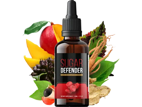 Prepare your body for the heatwave; discover how to maintain steady energy levels and avoid the mid-holiday crash here.Secure My Sugar Defender Now