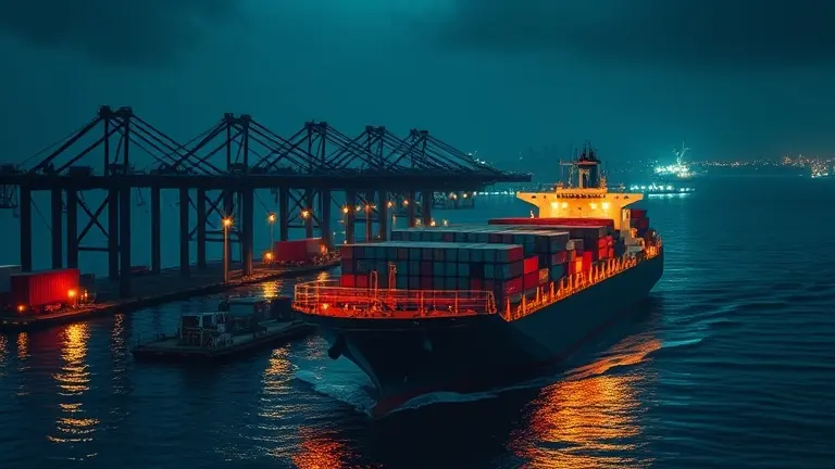
In today’s hyper-connected global economy, the movement of goods is no longer a silent, invisible process happening in the background. From the daily headlines about Red Sea logistics to the critical economic updates concerning Panama Canal throughput, marine traffic has emerged as one of the most vital indicators of geopolitical and financial health. For the modern news consumer, tracking these movements is no longer reserved for logistics professionals; it has become a necessary skill for anyone looking to understand the reality behind global inflation, scarcity, and trade volatility.
However, navigating the ocean of available data can be overwhelming. Without the right framework to distinguish between standard shipping routes and anomalies, it is easy to fall into the trap of speculation rather than analysis. Whether you are an OSINT researcher monitoring fleet movements or simply an observer trying to make sense of supply chain news, the challenge lies in moving from passive curiosity to technical proficiency.
This guide serves as your essential primer on maritime literacy. We will move beyond the basic maps to decode the technical language of Automatic Identification Systems (AIS), learn how to identify ‘dark’ vessels, and discover how to verify complex news reports using open-source tools. Just as in any highly technical discipline, mastering these data sets is about having the right blueprint to guide your investigation from start to finish, turning confusion into absolute clarity.
The Modern Era of Maritime Visibility: Why Global Supply Chains Matter

The surge in public interest surrounding marine traffic is not merely a hobbyist trend; it represents a fundamental shift in how the global population perceives economic stability. For decades, the movement of cargo was a background process, largely invisible to the average consumer. Today, however, heightened global volatility—ranging from climate-driven constraints like the recent droughts at the Panama Canal to persistent geopolitical tensions in the Red Sea—has transformed maritime logistics into a daily news cycle. As supply chain disruptions directly impact inflation, product availability, and energy costs, tracking vessel positions has transitioned from a niche logistics requirement to an essential tool for public awareness.
Why Supply Chain Visibility Is an Economic Indicator
The democratization of Automatic Identification System (AIS) data allows researchers, investors, and concerned citizens to act as amateur analysts. By monitoring global shipping lanes, observers can identify shifts in trade patterns long before they appear in mainstream economic reports. This real-time visibility acts as a pulse for the global economy, offering several key insights:
- Geopolitical Early Warning: Monitoring the deviation of oil tankers and cargo ships from primary routes often signals underlying tensions or security threats in critical maritime chokepoints.
- Predictive Pricing Power: By tracking the arrival times of container ships at major ports, analysts can forecast inventory gluts or shortages, providing a window into potential price fluctuations for essential goods.
- Climate Impact Analysis: Observational data regarding vessel density in canals highlights how environmental stressors force re-routing, which inherently drives up shipping costs and lengthens transit times.
In this era of hyper-connectivity, supply chain visibility has become a critical economic indicator. Understanding these flows allows stakeholders to decipher how localized maritime events ripple across the international market. Whether you are an OSINT researcher verifying naval exercises or a consumer trying to understand why a local store shelf remains empty, interpreting marine traffic data is the most direct way to bridge the gap between abstract global events and tangible economic outcomes.
Demystifying Maritime Data: A Guide to Technical Literacy
To effectively track marine traffic and interpret global supply chain news, one must first understand the underlying language of the sea: the Automatic Identification System (AIS). At its core, AIS is a transponder system that enables ships to broadcast their identity, position, speed, and course to other vessels and coastal stations. While once a tool exclusively for navigation and safety, it has become the backbone of modern Open Source Intelligence (OSINT). When you view a map on a tracking platform, you are essentially looking at a real-time visualization of these digital “handshakes.” Understanding AIS is the first step in moving from a casual observer to an informed analyst capable of distinguishing between standard maritime activity and actual anomalies.
Key Concepts in Global Shipping
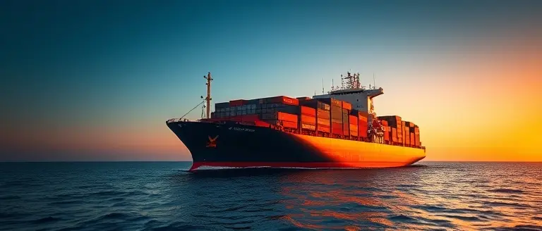
To translate maritime headlines into actionable insights, it is essential to categorize the “workhorses” of the global economy. Each vessel type serves a distinct function, and disruptions to their routes often signal specific economic or geopolitical shifts:
- Container Ships: The giants of consumer goods, these vessels carry standardized metal boxes containing everything from electronics to apparel. Tracking these provides the most accurate pulse on retail inventory and consumer demand.
- Tankers: Designed to transport liquids in bulk, these ships are the primary focus during energy crises. Changes in their traditional routes often indicate shifts in global oil or gas trade flows.
- Bulk Carriers: These vessels lack internal walls and are built to haul raw materials like iron ore, grain, and coal. Their movements are leading indicators for industrial manufacturing and global food security.
- Port Calls: This term refers to a vessel arriving at a designated terminal to load or unload. A sudden surge in port calls suggests economic growth, while extended “anchorage” times—where ships wait in circles outside a port—frequently indicate supply chain bottlenecks or port congestion.
By mastering these fundamental categories, you can better verify news reports regarding global trade volatility. Whether analyzing a headline about a tanker diverting due to regional conflict or a container ship stuck in a bottleneck, you now possess the basic vocabulary to evaluate the situation with the same technical clarity as an industry professional. Understanding these variables transforms “raw data” into a clear narrative of how the global economy truly moves.
OSINT in Action: How to Verify Supply Chain News

In an era where geopolitical tensions frequently disrupt global logistics, the ability to conduct independent Open Source Intelligence (OSINT) has become a vital skill for analysts, investors, and curious observers alike. By leveraging marine traffic data, you can move beyond speculative news headlines to verify the actual movement of cargo vessels in real-time. The verification process begins by cross-referencing claims found on social media or news outlets with standardized Automatic Identification System (AIS) data. If a report claims a port is blocked or a tanker is stalled, use a tracking platform to inspect the vessel’s current coordinates, destination status, and speed. A ship that is “anchored” for an extended duration in an unusual location often provides the visual evidence needed to validate or debunk breaking supply chain reports.
Identifying Anomalies and “Dark” Maneuvers
To truly master maritime literacy, you must look for discrepancies in historical data. Most professional platforms allow you to view a vessel’s track history, which acts as a “digital fingerprint” for its operations. When investigating potential supply chain disruptions, focus on these critical indicators:
- AIS Gaps: If a vessel’s signal suddenly disappears while transiting a high-risk area, it may be intentionally disabling its transponder—a common tactic known as “going dark” to evade sanctions or mask illicit cargo transfers.
- Deviation from Standard Routes: Use historical route overlays to spot vessels taking circuitous paths, which may indicate deliberate avoidance of conflict zones or attempts to bypass congested bottlenecks like the Panama Canal.
- Port Congestion Patterns: Compare current vessel density maps against long-term averages to determine if a reported “supply chain collapse” is an actual crisis or merely seasonal fluctuations in regional shipping activity.
By comparing these metrics against official port authority notices and verified news feeds, you can effectively filter out misinformation. Remember that AIS data is a tool for transparency, not an infallible record; by understanding its technical limitations—such as satellite update delays and intentional signal spoofing—you transform yourself from a passive consumer of news into an informed researcher capable of identifying the reality behind global marine traffic movements.
The Limitations of AIS: Understanding ‘Dark’ Vessels

While marine traffic tracking platforms provide an unprecedented window into global logistics, it is a common misconception that the Automatic Identification System (AIS) acts as a perfect surveillance net. In reality, AIS was designed primarily for collision avoidance rather than global oversight. Because the system relies on ships broadcasting their own location, identity, and course via VHF radio frequencies, it remains inherently susceptible to manipulation. When a vessel intentionally disables its transponder or “spoofs” its location—a practice commonly referred to as sailing “dark”—it effectively vanishes from standard digital maps. This creates a significant blind spot for supply chain analysts and OSINT researchers who rely exclusively on public-facing data to verify global shipping movements.
The Mechanics of ‘Dark’ Fleets
The rise of the “dark fleet”—a collection of tankers and cargo vessels that operate without active AIS signals—is often linked to the evasion of international sanctions, illicit ship-to-ship transfers, or efforts to conceal movement through geopolitical hotspots. Understanding the limitations of this data requires recognizing the common tactics used to bypass monitoring:
- Transponder Deactivation: Vessels may manually switch off their AIS transponders when entering sensitive waters or approaching prohibited ports to avoid detection by authorities and satellite imagery.
- Location Spoofing: Sophisticated operators can manipulate their AIS transmissions to project a false location, sometimes creating the appearance of being in an open ocean lane while the vessel is actually docked at a sanctioned facility.
- Satellite Latency: Because AIS signals rely on both terrestrial receivers and satellite constellations, gaps in coverage occur, especially in remote regions or areas with high signal interference, making it difficult to maintain a continuous, high-fidelity trail for every vessel.
For the modern investigative researcher, these gaps are not just technical inconveniences but critical data points. The absence of a signal is, in itself, a form of intelligence. When interpreting marine traffic data, seasoned observers look for “AIS gaps” as a primary indicator of suspicious activity. By cross-referencing these outages with synthetic aperture radar (SAR) or optical satellite imagery, analysts can often confirm the physical presence of a vessel even when its digital identity is intentionally hidden. Recognizing these technical constraints is essential for anyone looking to transform basic tracking into actionable maritime literacy.
Moving from a casual observer to a seasoned maritime analyst requires more than just access to a live map; it demands a structured approach to interpreting complex, often fragmented data. By understanding the nuances of AIS signals, the reality of ‘dark’ fleets, and the broader economic indicators inherent in global shipping, you have taken the first step toward true maritime literacy. Yet, this investigative mindset is just one piece of a larger technical puzzle.
Just as analyzing maritime traffic requires more than just looking at a map, successfully executing any complex technical project requires the right set of verified, foolproof blueprints rather than incomplete, guess-work alternatives. The frustration of working with vague data is no different than trying to build a structure with imprecise measurements—the result is never what you envisioned. To achieve professional-grade clarity in your personal projects, you need the same systematic methodology used to decode the world’s most complex logistics networks.
Master your craft with the precision we apply to maritime intelligence. With Ted’s Woodworking, you gain access to the industry’s most comprehensive library of verified plans, providing the structural foundation and technical certainty required to build world-class results from start to finish. Stop relying on trial-and-error; start building with the confidence of an expert.

Master your craft with the same precision we apply to maritime intelligence; explore the industry’s most comprehensive library of verified plans here.