
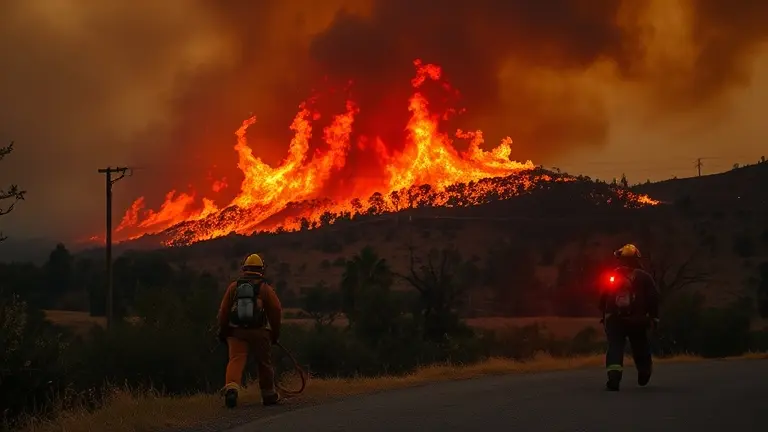
The morning of May 18, 2026, forever altered the landscape of Simi Valley as the Sandy Fire ignited near Sandy Avenue, quickly escalating into a critical wildfire emergency. With approximately 1,700 acres scorched and only 15% containment as of today, May 20, the situation remains fluid and dangerous. Driven by relentless gusty winds and the challenging terrain of our local canyons, the blaze has necessitated mandatory evacuations for thousands of residents. As nearly 900 firefighters battle the flames, families across Ventura County are facing the urgent reality of road closures and the uncertainty of displacement.
We understand that in times of crisis, navigating broad news reports can be overwhelming when all you need are answers for your specific neighborhood. This Live Crisis Hub is dedicated to providing you with actionable intelligence, real-time safety updates, and essential resources to help you and your loved ones stay secure. Whether you are seeking clarity on evacuation zones or looking for ways to mitigate the physical impact of hazardous air quality, we are here to ensure you have the most reliable, localized information at your fingertips as we face this challenge together.
Current Status: Sandy Fire in Simi Valley
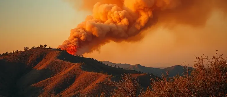
As of May 20, 2026, the Sandy Fire in Simi Valley remains a high-priority incident for emergency responders across Ventura County. The blaze, which first ignited on the morning of May 18 near Sandy Avenue, has aggressively expanded through the local landscape. According to the latest reports from CAL FIRE, the fire has consumed approximately 1,700 acres. While firefighting crews have managed to establish 15% containment, the situation remains fluid, and residents in the surrounding areas are urged to stay vigilant regarding potential fires near me updates and shifting evacuation orders.
Environmental Challenges and Firefighting Efforts
The intensity of the Sandy Fire is largely attributed to a combination of difficult environmental factors. Steep, rugged canyon terrain has hindered ground access, while persistent, gusty winds have pushed the flames into suburban zones, complicating suppression efforts. These dry conditions are classic indicators of the volatility associated with California fires during this time of year. To combat the spread, a massive mobilization is currently underway:
- Personnel: Nearly 900 firefighters are on the front lines, working around the clock to build containment lines.
- Tactical Operations: Crews are utilizing both aerial support and heavy machinery to cut firebreaks and protect residential structures.
- Impact: Authorities have confirmed the destruction of at least one structure, with thousands of residents forced to evacuate their homes to ensure safety.
For those searching for “fire near me” or looking for specific Simi Valley safety updates, it is essential to rely on verified information from official sources. The combination of erratic wind patterns and high-fuel density in the canyons means that the containment percentage can change rapidly. Residents should monitor local emergency alerts closely and prepare for potential changes in evacuation zones as crews continue their defense of the community.
Evacuation Orders and Safety Zones

Navigating the rapidly shifting landscape of the Sandy Fire in Simi Valley requires immediate access to verified, real-time data. As of May 20, 2026, thousands of residents remain under active evacuation orders. Because conditions change rapidly due to gusty winds and rugged terrain, relying on social media rumors is dangerous. Residents must prioritize official communication channels to determine if their specific neighborhood falls within a mandatory or voluntary zone. To verify your home’s status, visit the official Ventura County Emergency Information website or the CAL FIRE incident dashboard, which provide the most granular, block-by-block updates currently available.
Understanding ‘Ready, Set, Go’ Protocols
Emergency management officials utilize the “Ready, Set, Go” framework to guide residents through fire-related threats. Understanding these stages is vital for your family’s safety:
- Ready (Pre-Evacuation): Prepare your household by creating a disaster plan, gathering essential documents, and hardening your home against embers. Monitor local news and fires near me alerts.
- Set (Situational Awareness): Stay alert for potential evacuation orders. Pack your vehicle with pre-assembled emergency supplies, keep your gas tank full, and ensure your mobile devices are charged.
- Go (Evacuation): If local authorities issue a mandatory order, leave immediately. Do not hesitate to gather non-essential belongings. Follow designated evacuation routes provided by the Ventura County Sheriff’s Office.
For those displaced by the California fires, keeping a log of road closures is essential. Avoid all areas near the fire perimeter to allow emergency responders to move freely. If you are uncertain about the safety of your street, sign up for local emergency alerts via the Ventura County “VC Alert” system. By centralizing your information intake through these official portals, you ensure that you are making decisions based on verified, life-saving intelligence rather than speculative updates.
Live Map and Traffic Updates

Navigating the Sandy Fire in Simi Valley requires real-time situational awareness, as conditions on the ground change rapidly due to shifting wind patterns and containment progress. As of May 20, 2026, major arterial roads remain compromised, and multiple evacuation zones are strictly enforced by local law enforcement. Residents looking for “fires near me” should rely exclusively on verified interactive maps, such as the official CAL FIRE incident dashboard, to identify active fire perimeters and road closures. Because the fire originated near Sandy Avenue, commuters should anticipate significant delays on primary thoroughfares and are urged to avoid the area entirely to ensure that emergency vehicles have unobstructed access to the front lines.
Essential Tools for Monitoring Traffic and Safety
To monitor your specific neighborhood and plan safe exit routes, utilize the following high-priority resources:
- VC Emergency (readyventuracounty.org): The definitive source for up-to-the-minute evacuation orders, road closure alerts, and shelter locations.
- CHP Traffic Incident Information: Check the California Highway Patrol website for live status updates on highway restrictions affecting the Simi Valley area.
- PulsePoint App: Many residents utilize this application to monitor public safety dispatch traffic, which can provide an early warning regarding new flare-ups or blocked egress routes before they are formally mapped.
- Official Social Media Feeds: Monitor the Ventura County Sheriff’s Department and CAL FIRE on X (formerly Twitter) for real-time adjustments to evacuation zones that may not yet appear on standard GPS apps like Google Maps or Waze.
When fleeing an area, do not rely on a single navigation app, as signal interference and cellular congestion are common during California fires. If you are under an evacuation order, follow the directions of local authorities immediately; they are coordinating with emergency response teams to keep major evacuation corridors open. Keep your fuel tank at least half-full and maintain an emergency go-bag in your vehicle to ensure you can depart immediately if conditions deteriorate. Always treat road closures as permanent until an official government source confirms that a thoroughfare has been reopened to the public.
Emergency Resources and Support Services

For residents navigating the ongoing Sandy Fire in Simi Valley, immediate access to reliable information is critical. As CAL FIRE teams work to increase containment beyond the current 15%, local agencies have established a centralized support system to assist those affected by mandatory evacuations. Whether you are seeking physical shelter or logistical guidance for your property, the following verified resources should serve as your primary point of reference for safety and assistance.
Immediate Support and Sheltering
If you have been displaced by the fires near me, please prioritize personal safety and follow all active evacuation orders. The American Red Cross is coordinating emergency shelters for individuals forced to leave their homes due to the California fires. Residents are encouraged to check the official Ventura County emergency portal for the most current shelter locations, as these can change rapidly based on wind direction and fire spread.
- Ventura County Emergency Information: Monitor the official county incident dashboard for real-time updates on road closures and evacuation zone modifications.
- American Red Cross (Southern California): Visit the Red Cross website to find active congregate shelters equipped with basic amenities and medical support.
- Pet Evacuation: Local animal services are currently managing designated pet-friendly evacuation centers. Ensure you have your animal’s medical records and a transport crate ready if you are in an “evacuation warning” zone.
- Air Quality Monitoring: Use platforms like IQAir to track smoke levels in Simi Valley, especially if you have underlying respiratory conditions, as wind-driven smoke remains a significant concern for the surrounding suburban areas.
Remaining informed through official channels is the best way to ensure you receive timely notifications regarding repopulation efforts and utility restoration. Avoid relying on speculative social media reports; instead, utilize the official CAL FIRE incident page for updates on the 1,700-acre blaze. By consolidating these resources, your household can better prepare for the dynamic nature of this wildfire incident and access the help needed during this challenging time.
Securing Your Health Amidst the Smoke
As the Sandy Fire continues to challenge the Simi Valley community, staying informed and prepared remains your most powerful defense. Beyond monitoring evacuation zones and traffic updates, it is essential to remember that environmental stress takes a physical toll on your body. The particulate matter from wildfire smoke can cause significant irritation to your sinuses and respiratory system, creating a long-term health risk even as the immediate threat subsides.
While your primary focus is understandably on safety and logistics, proactively supporting your body’s natural defenses is a vital, often overlooked step. We recommend incorporating ProDentim into your daily routine during this challenging time. By fostering a healthy balance of bacteria in the mouth and sinuses, ProDentim acts as a strategic wellness intervention, helping you maintain respiratory resilience against the lingering ash and smoke.
Taking care of yourself is the foundation of your family’s ability to navigate this crisis. Prioritize your well-being today to ensure you stay strong for the days ahead. Don’t let respiratory fatigue compromise your recovery—choose a proactive path to better health.
 Support your respiratory system against smoke irritation: Learn how ProDentim helps maintain oral and sinus health.Protect My Respiratory Health Now!