

As Tropical Depression Two churns through the Gulf of Mexico, meteorologists are closely watching for signs of intensification into Tropical Storm Bertha. For residents across the Texas Gulf Coast, the atmosphere is shifting from routine summer observation to a state of heightened meteorological anticipation. While the exact trajectory remains subject to evolving spaghetti models and official National Hurricane Center updates, the potential for landfall—or significant fringe impacts—is driving a surge in searches for accurate weather tropical storm weather forecasts and reliable tracking information.
However, tracking the storm is only half the battle. While staying updated on the latest tropical storm watch bulletins is essential for safety, the real challenge for Texas homeowners lies in transitioning from anxiety-driven observation to hyper-local impact assessment. Whether you are situated in a flood-prone municipality or inland, the priority must be moving beyond the “cone of uncertainty” and into active, structural preparedness. How ready is your home to withstand the potential wind and rain? In this guide, we cut through the noise of constant news updates to provide you with actionable, reliable, and tactical steps to harden your property before the weather shifts.
Tropical Depression Two: Current Status and Gulf Coast Projections
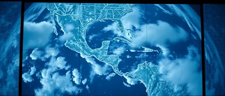
As of July 20, 2026, meteorologists are closely monitoring Tropical Depression Two, a system currently situated in the Gulf of Mexico that shows signs of continued organization. According to the latest data from the National Hurricane Center (NHC), the system is poised to strengthen into Tropical Storm Bertha later today. For residents across the Gulf Coast—including those in Texas—this development marks a critical juncture in the tropical storm weather forecast. While the system is currently classified as a depression, the shift toward a named storm status necessitates increased vigilance regarding rainfall projections and potential coastal surge.
Understanding the Forecast and Potential Path
The current NOAA forecast path indicates that the storm’s trajectory remains fluid. While the central cone of uncertainty extends from the Florida Panhandle westward, potential impacts for the Texas coastline remain within the area of interest. It is vital to note that early spaghetti models often show variance; therefore, residents should rely on official updates rather than isolated speculation. Key factors currently influencing the path include:
- Atmospheric Steering Currents: Prevailing winds are currently guiding the system, but shifts in high-pressure ridges could alter the final landfall location.
- Environmental Conditions: Warm waters in the Gulf of Mexico provide the fuel necessary for intensification, which is why a tropical storm watch may be issued for coastal municipalities on short notice.
- Regional Vulnerabilities: Regardless of the exact landfall point, the primary threats for Texas include heavy precipitation, localized flash flooding, and dangerous rip currents.
To stay ahead of the weather, residents should utilize a reliable tracker provided by official meteorological outlets. Because these systems can evolve rapidly, monitoring the tropical storm weather forecast every few hours is recommended. Official sources, such as the NHC, provide the most accurate assessment of the storm’s intensity and movement. As we await the official designation of Tropical Storm Bertha, prioritizing preparedness over panic is the most effective approach for those in the potential path.
Texas Preparedness: Assessing Regional Vulnerabilities
As Tropical Depression Two progresses toward a potential upgrade to Tropical Storm Bertha, residents across the state must shift from passive monitoring to proactive risk assessment. Texas geography creates a wide spectrum of vulnerabilities; while coastal communities face the immediate threat of storm surge and high-velocity winds, inland regions—including major metropolitan hubs—often experience the most severe impacts from localized, catastrophic inland flooding. Understanding your specific municipal risk is the first step in effective emergency planning. Residents should consult FEMA flood maps alongside current tropical storm weather forecast data to determine if their property resides in a high-risk zone for drainage failures or flash flooding.
Tailored Preparedness Strategies
The transition from a depression to a named storm often brings rapid changes in rainfall projections. To maintain safety, Texans should implement tiered preparedness plans based on their specific geographic vulnerability:
- Coastal Residents: Focus on evacuation routes and “go-bags.” Verify that your home is secured against heavy winds and that you have a plan for securing outdoor equipment that could become projectiles.
- Inland/Low-Lying Areas: Prioritize flood mitigation. Clear gutters and downspouts of debris, raise critical documents to higher shelves, and ensure your communication plan accounts for potential localized power disruptions.
- Utility Resilience: Since severe weather often causes localized grid instability, keep mobile devices fully charged, maintain a three-day supply of non-perishable food, and prepare manual lighting sources.
Reliable information remains your best defense against the uncertainty surrounding the tropical storm watch. While tracking sites provide a broad tracker overview, your local county emergency management office remains the ultimate authority on mandatory versus voluntary evacuation orders. Avoid relying on speculative social media models; instead, tether your decision-making process to verified reports from the National Hurricane Center. By assessing your regional risk now—before the system intensifies—you ensure that your household remains resilient regardless of the ultimate landfall path.
Travel and Safety Disruptions: What Residents Need to Know

As Tropical Depression Two progresses toward its expected designation as Tropical Storm Bertha, Texas residents should prepare for potential travel disruptions across major corridors. Meteorological anticipation suggests that while the storm’s trajectory is still evolving, the northern Gulf Coast and interior Texas regions may face significant weather-related hazards. Travelers should exercise caution as the tropical storm weather forecast indicates the potential for localized heavy rainfall, which frequently leads to flash flooding on low-lying secondary roads and major highways, including sections of I-10 and I-45. Even if the storm does not make direct landfall, the moisture influx associated with a tropical storm watch can cause sudden visibility issues and hydroplaning risks, significantly impacting daily logistics and long-distance travel.
Airport Advisories and Transit Logistics
In addition to road conditions, major aviation hubs in the Gulf Coast region may experience cascading flight delays or cancellations as airlines adjust schedules to account for shifting winds and storm tracks. Passengers with travel plans through Tuesday, July 21, are encouraged to check their flight status through official airline websites or the FAA’s current system status page. It is essential to monitor real-time updates rather than relying on standard schedules, as air traffic control may implement ground stops to ensure safety during periods of high gust activity.
To remain informed and minimize reactive stress, residents should rely on verified, high-authority information channels:
- DriveTexas.org: The official resource for real-time road closures, flooding alerts, and construction updates across the state.
- National Hurricane Center (NHC): For the most accurate tracker data and official advisories regarding the evolution of the storm.
- Local Emergency Management Sites: County-specific dashboards often provide hyper-local evacuation orders or shelter-in-place recommendations.
- National Weather Service (NWS) Austin/San Antonio: For specific meteorological impacts affecting Central Texas.
By consulting these resources, Texans can make proactive decisions, such as delaying non-essential travel or adjusting routes to avoid areas flagged for potential inundation. Staying prepared involves treating this weather event with a steady, informed approach rather than panic, ensuring that your travel itinerary remains flexible as the tropical storm weather forecast updates throughout the week.
Staying Informed: Using Official NOAA and NHC Channels

As Tropical Depression Two progresses toward a potential upgrade into Tropical Storm Bertha, the volume of circulating information can become overwhelming. To remain safe, residents across Texas and the Gulf Coast must prioritize the National Hurricane Center (NHC) and NOAA as their “single source of truth.” Official portals provide the most accurate weather tropical storm bertha updates, ensuring you are not misled by speculative social media posts or outdated forecast graphics. Relying on verified data is essential for making informed decisions regarding your household’s safety and potential evacuation needs.
Understanding Forecast Models and the Cone
When monitoring the tropical storm weather forecast, it is common to encounter “spaghetti models.” These visual tools depict various computer-simulated paths for a storm; however, they can often be misinterpreted by the layperson.
- The Cone of Uncertainty: Always focus on the official NHC “cone,” which represents the probable track of the storm’s center. The cone accounts for historical forecast errors, meaning the storm could track anywhere within that shaded area.
- Avoid Over-Analysis: Do not treat a single model line as a definitive destination. Instead, look for the clustering of models, which indicates higher confidence among meteorologists.
- Official Updates: Always verify if a tropical storm watch has been issued for your specific county. Local affiliates, such as KXAN, utilize these exact NOAA data sets to provide hyper-local impact assessments.
During times of high meteorological activity, misinformation spreads rapidly. If you see a map showing an extreme, high-impact scenario that is not mirrored on the official NHC website, it is likely outdated or unauthorized. Stick to primary sources to ensure you have the most current information regarding landfall potential and heavy rain threats as this system evolves. By prioritizing official tracker data, you ensure that your preparedness plan is based on science rather than speculation.
Fortify Your Home Against Tropical Threats
Staying informed on the progress of Tropical Depression Two—and the potential development of Tropical Storm Bertha—is the first step toward safety, but passive monitoring is no longer enough. As meteorologists analyze the spaghetti models and the Gulf Coast braces for potential impact, the most effective strategy for Texas residents is to move from a state of observation to a position of proactive defense. Ensuring your property is physically reinforced against high winds and heavy rainfall is the most critical insurance policy you can have during hurricane season.
While tracking weather maps helps you understand the storm’s path, true preparedness requires structural resilience. This is where Ted’s Woodworking becomes an essential asset in your disaster preparedness toolkit. By utilizing professional-grade, workshop-tested plans, you can construct custom shutters, reinforced storage solutions, and secondary flood barriers that standard off-the-shelf options simply cannot match. This isn’t just a hobby; it is a vital layer of home hardening that transforms your DIY skills into a robust line of defense against the unpredictability of tropical weather.
Don’t wait for the storm to reach the coastline to realize your home’s vulnerabilities. Taking action now secures your property and provides peace of mind when weather alerts start to escalate. Build the protection you need today with precision and reliability.
 Download these workshop-tested plans today to secure your property before the storm reaches the Gulf Coast.Yes, I Want To Secure My Home Now!