
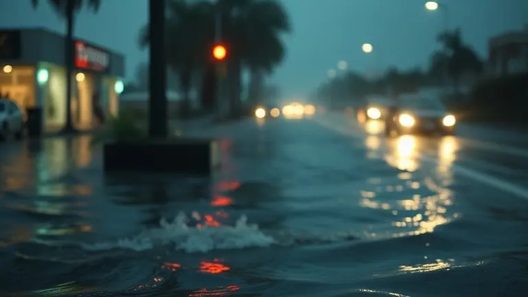
As Tropical Storm Arthur barrels toward the coast and flash flood alerts flicker across smartphone screens from Ohio to Texas, the urgency of the 2026 summer weather season has arrived with full force. For millions of residents, the ping of a flood warning is a high-stakes trigger that demands immediate action. Yet, in the chaos of tracking real-time meteorological shifts, it is all too easy to miss the life-saving distinction between a watch and a warning—or to feel paralyzed by the lack of a clear, actionable plan when the water begins to rise.
This guide serves as your essential resource for navigating the instability of this hurricane season. We move beyond the ephemeral headlines to provide a durable, utility-driven framework for survival and property protection. By understanding the mechanics of these alerts and adopting a strategy of proactive home hardening, you can transform your role from a passive observer of disaster news into a prepared guardian of your home and family. Your safety starts with information, but it is cemented by preparation.
Understanding Current Flood Risks: June 2026 Weather Update

The mid-June 2026 landscape is defined by an unusually high volume of hydrological instability across the United States, primarily driven by the arrival of Tropical Storm Arthur. As the inaugural named system of the 2026 Atlantic hurricane season, Arthur has brought significant atmospheric moisture to the Gulf Coast, triggering widespread flood warning alerts that extend well inland. The meteorological phenomenon is characterized by slow-moving, high-precipitation bands that challenge existing drainage infrastructure, turning urban centers and coastal lowlands into high-risk zones for sudden inundation.
Beyond the immediate coastal impacts of Tropical Storm Arthur, the central United States is experiencing simultaneous severe weather clusters. Regions across Texas and the Midwest, including cities like Cincinnati, are reporting repeated bouts of heavy convective rainfall. This convergence of tropical moisture from the south and instability patterns in the heartland has created a complex, multi-regional safety challenge. The reason for the current surge in emergency alerts is twofold:
- Soil Saturation: Previous, lighter rainfall events have left the ground unable to absorb additional precipitation, leading to near-instantaneous surface runoff.
- Urban Density: In metropolitan areas, impervious surfaces such as concrete and asphalt accelerate flash flooding, making local alerts essential for public safety.
For residents in affected zones, these alerts are not mere suggestions; they are reactive signals that life-threatening water levels may be imminent. Staying informed through the National Weather Service (NWS) and local emergency management platforms is the most effective way to navigate these risks. By monitoring the transition from flood watches to formal flood warning status, citizens can better distinguish between conditions that merely necessitate heightened awareness and those that require immediate, decisive action to preserve life and property during this active start to the summer season.
Flood Watch vs. Flood Warning: Know the Difference
Understanding the specific terminology issued by the National Weather Service (NWS) is critical for public safety, especially during active weather events like the current Tropical Storm Arthur. Misinterpreting these alerts can lead to delayed reactions during life-threatening situations. When authorities issue a weather alert, it is vital to distinguish between the potential for danger and the immediate presence of a hazard.
Flood Watch: Prepare for Action
A Flood Watch signifies that conditions are favorable for flooding to occur in or near the watch area. It does not mean that flooding is guaranteed; rather, it indicates that the risk has elevated significantly. When a watch is active, you should:
- Stay Informed: Monitor local news stations or weather radio for updates.
- Review Plans: Locate your emergency kit and ensure your family knows your evacuation route.
- Clear Drains: If safe to do so, clear debris from nearby storm drains to prevent localized ponding.
Flood Warning: Immediate Threat
In contrast, a Flood Warning indicates that flooding is imminent or already occurring. This is the most urgent level of alert and requires immediate action to protect life and property. If a warning is issued for your area, you must:
- Seek Higher Ground: If you are in a flood-prone area, move to higher ground immediately without waiting for an evacuation order.
- Avoid Water: Never attempt to drive through flooded roads. Turn around, don’t drown; as little as six inches of moving water can knock an adult off their feet, and two feet can sweep away most vehicles.
- Follow Instructions: Adhere strictly to directives from local emergency management officials and law enforcement.
By understanding these distinctions, you can shift from a state of general preparedness to decisive, life-saving action as severe weather systems evolve.
Immediate Safety Protocols: Evacuate or Shelter-in-Place?
When a flood warning is issued for your area, your decision to either evacuate or shelter-in-place can be the difference between safety and a life-threatening emergency. If local authorities issue a mandatory evacuation order, you must leave immediately. Do not wait for water to become visible, as flash flooding—common during active weather events like Tropical Storm Arthur—can occur with little to no warning, often turning roads into impassable rivers in seconds. If you are instructed to stay put, move to the highest level of your home, such as a second floor or attic, and avoid basements or ground-level rooms where water accumulation is most likely.
When to Evacuate
You should prioritize evacuation if you fall into any of the following categories:
- You live in a designated high-risk flood zone or a low-lying area prone to rapid drainage issues.
- Your home is a mobile home or temporary structure that cannot withstand high winds or rising water.
- Official sources report that water levels are rising toward your property lines or structural integrity is compromised.
- You see water entering your primary living space; at this point, electricity should be turned off if accessible, and you must move to higher ground immediately.
Emergency ‘Go Bag’ Essentials
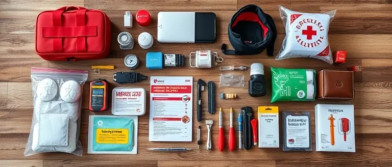
If you are forced to evacuate, having a pre-packed bag allows for a faster, safer exit. Ensure your kit includes:
- Government-issued identification and important insurance documents in a waterproof bag.
- A three-day supply of non-perishable food and one gallon of water per person per day.
- A battery-powered or hand-crank radio to track real-time NWS alerts and weather updates.
- Mobile device chargers and power banks.
- Essential medications and a basic first-aid kit.
- Sturdy, waterproof footwear and extra changes of clothing.
If you are trapped and unable to reach higher ground, do not attempt to drive through flooded roadways. “Turn Around, Don’t Drown” remains the most critical rule during Gulf Coast flooding events. Contact emergency services, provide your exact location, and signal for help from an upper-story window if safe to do so.
Real-Time Tracking: Digital Resources for Local Alerts

In the event of a flood warning, relying on a single source of information can be dangerous. As seen during the impacts of Tropical Storm Arthur and ongoing June severe storms, conditions can shift rapidly, making real-time data your most critical survival asset. To stay ahead of life-threatening flooding, you should establish a redundant communication plan that ensures you receive alerts even if cellular networks or grid power become intermittent.
Official Weather Monitoring Platforms
The most reliable information originates directly from federal and regional meteorological authorities. Experts recommend bookmarking these high-utility digital resources for immediate access during an emergency:
- National Weather Service (weather.gov): Your primary source for official NWS watches and warnings. Enter your zip code to view hyper-local radar and active hazard statements.
- NOAA Weather Radio (NWR): Often called the “Voice of the National Weather Service,” these radios are essential for receiving 24/7 broadcasts. Ensure your device is programmed for your specific county’s SAME code.
- FEMA Mobile App: This tool provides real-time alerts from the National Weather Service for up to five different locations, along with safety tips and shelter-in-place instructions.
- Local Emergency Management Apps: Many municipalities in high-risk zones, such as Gulf Coast counties, utilize platforms like Everbridge or CodeRED to send hyper-local push notifications about road closures and evacuation orders.
Redundancy Strategies for Maximum Safety
Do not rely exclusively on social media or news headlines, which may be delayed or prone to misinformation. Instead, enable Wireless Emergency Alerts (WEA) on your smartphone. These are broadcast through your cellular provider and do not require an app; they will trigger even if your phone is set to silent or “Do Not Disturb” mode. When a flash flood warning is issued, having both a digital source and an analog backup—such as a battery-powered NOAA radio—ensures you remain informed if the power grid fails or data speeds throttle. Always cross-reference your local government’s official social media pages, as they often provide the most granular detail on localized flood risks that may not yet appear on national weather maps.
Taking Control: Fortify Your Home Against Future Storms
Understanding the difference between a flood watch and a warning is the first step toward safety, but true peace of mind comes from knowing your home is structurally prepared to face the elements. While real-time alerts provide the critical data you need to evacuate or shelter, your second line of defense is the physical resilience of your property. Weather events like Tropical Storm Arthur serve as a stark reminder that nature is unpredictable, and waiting until a storm is on the horizon is often too late to begin significant home hardening.
This is where proactive home maintenance becomes a vital aspect of disaster readiness. By having the right technical blueprints at your fingertips, you move from reactive observation to effective, hands-on protection. Whether you need to build custom window shutters, reinforce door frames, or construct temporary water diversion barriers, precision is the difference between minor maintenance and devastating structural loss. Ted’s Woodworking provides the ultimate property resilience toolkit, offering over 16,000 professional-grade workshop plans to ensure your DIY projects are built with durability and absolute technical certainty.
Investing in your home’s structural integrity today is an investment in your family’s security tomorrow. Don’t wait for the next alert to realize you lack the specifications for crucial repairs. Secure your property now and ensure you have the architectural resources to handle whatever the Atlantic hurricane season brings.
 Build your resilience: Get instant access to 16,000 expert blueprints and fortify your home against the elements today.Secure My Professional Blueprints Now!