
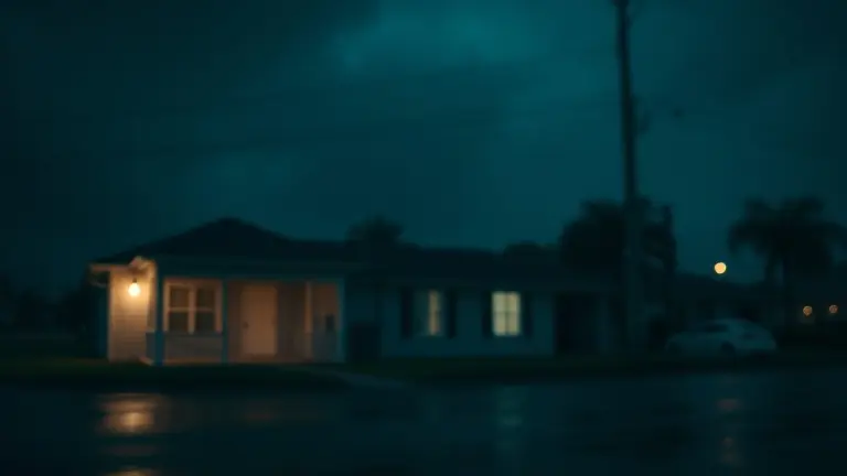
The Atlantic hurricane season has officially entered a high-stakes phase with the formation of Tropical Storm Arthur in the Gulf of Mexico. For residents across Texas and Louisiana, this is more than just a weather alert—it is an immediate call to action. Following the widespread instability that impacted 41 states earlier this month, the anxiety surrounding this latest development is palpable. While meteorological maps track Arthur’s path, the reality on the ground demands a shift from passive observation to urgent, hyper-local preparation. The window to reinforce your property and organize your flood-safety measures is closing rapidly.
This guide bypasses the generic updates to provide you with an actionable, survival-focused checklist specifically tailored to the current Gulf region threats. Beyond stocking supplies, the true test of your home’s resilience lies in its physical structural integrity. As weather patterns become more unpredictable, the ability to rapidly deploy DIY home-hardening techniques is not just an advantage—it is a critical necessity for every homeowner standing in the path of this season’s first named storm.
Tropical Storm Arthur: Current Status and Regional Impact

As of June 17, 2026, Tropical Storm Arthur has officially formed in the Gulf of Mexico, marking the first named system of the 2026 Atlantic hurricane season. Meteorological data identifies this storm as a unique weather phenomenon, having completed a rare transition from a Pacific cyclone into an Atlantic system. Current tracking indicates that the storm is gaining strength as it moves across the Gulf, with landfall projections placing the primary impact zones along the coastlines of Texas and Louisiana. The National Weather Service (NWS) has issued urgent warnings regarding the potential for life-threatening flooding, storm surges, and intense precipitation throughout these regions. Residents in low-lying coastal areas should prioritize local evacuation orders and remain alert for rapidly shifting weather data.
Managing Seasonal Anxiety and Regional Risks
The emergence of Arthur follows an exceptionally volatile weather period in the United States, specifically the massive 41-state storm outbreak that occurred between June 10 and June 12, 2026. This recent event, which caused widespread structural damage and power outages, has left many communities feeling vulnerable to further instability. However, experts emphasize that while the current season is demonstrating early activity, it is vital to approach the situation with preparation rather than alarm. By focusing on verified NWS forecasts and local news, residents can better distinguish between routine seasonal development and high-risk extreme weather events.
Critical Safety Priorities
To navigate the current threat, residents in the projected path should adopt a proactive safety posture:
- Monitor Local Updates: Rely exclusively on official NWS updates and local news affiliates for neighborhood-level flood alerts and evacuation timing.
- Review Emergency Kits: Ensure that your emergency supplies—including non-perishable food, water, and medical kits—are accessible for immediate departure if necessary.
- Infrastructure Assessment: Clear debris from around your property to mitigate potential hazards caused by high winds and heavy rainfall.
- Understand Your Zone: Identify whether your residence falls within a designated flood-risk or evacuation zone; do not wait for a formal siren to prepare your departure plan.
Given the scientific uniqueness of this system, authorities are monitoring the storm’s trajectory closely. Preparedness remains the most effective tool in mitigating risks associated with this early-season activity.
Pre-Landfall Checklist for Gulf Coast Residents
With the arrival of Tropical Storm Arthur in the Gulf of Mexico, residents across Louisiana and Texas must transition immediately from situational awareness to decisive action. Meteorologists warn that the unique transition of this system necessitates a rapid response, particularly regarding life-threatening flooding and severe wind gusts. The following checklist is designed to help you secure your household before weather conditions deteriorate. Time is the most critical factor; if local officials issue evacuation orders for your zone, prioritize personal safety over property protection.
Immediate Property and Safety Protocols
- Secure Outdoor Hazards: Bring in all patio furniture, grills, potted plants, and children’s toys. These items can become dangerous projectiles in high winds. If an object cannot be moved inside, anchor it securely to a fixed structure.
- Fortify Entry Points: Check that all storm shutters are locked. If you do not have shutters, use 5/8-inch marine plywood to board up windows and glass doors.
- Digitize Vital Records: Store copies of your insurance policies, medical records, property deeds, and identification on a password-protected cloud drive or a waterproof USB flash drive. Keep a physical copy in a watertight bag for your “go-bag.”
- Establish a Communication Plan: Designate an out-of-state contact person whom all family members can notify upon reaching safety. Cell towers may experience outages during the storm, so memorize essential phone numbers or keep them written in a durable, waterproof notebook.
The 72-Hour Survival Kit
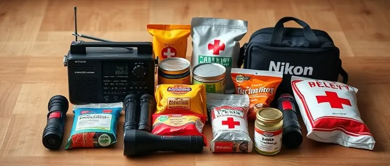
Ensure your emergency kit is easily accessible. Each member of your household should have at least one gallon of water per day for three days, along with a supply of non-perishable food items. Include a battery-powered or hand-crank NOAA Weather Radio to receive emergency alerts even if the grid fails. Ensure all mobile devices are fully charged and keep portable power banks on hand. Finally, keep a fully stocked first-aid kit and a seven-day supply of any prescription medications in a sealed container to prevent water damage during potential flooding events.
Understanding Evacuation Zones vs. Flood-Risk Areas

As Tropical Storm Arthur approaches the Gulf Coast, distinguishing between official evacuation zones and generalized flood-risk areas is a critical component of your personal safety strategy. An evacuation zone is a specific geographic boundary defined by local emergency management officials based on storm surge vulnerability, historical surge data, and topography. If local authorities issue an evacuation order, it is a mandatory or advisory directive to leave your residence because the risk to life—often from storm surge—has reached a critical threshold. In contrast, a flood-risk area—often identified on FEMA Flood Insurance Rate Maps—indicates the statistical probability of flooding from heavy rainfall or overflow, regardless of whether a storm has triggered a formal evacuation.
Do not rely solely on national weather broadcasts for your safety status. While generalized reports from the National Weather Service (NWS) provide essential meteorological data about the storm’s track, they cannot dictate local government requirements. Your primary source of truth must be your county’s emergency management website or official alerts.
To determine your specific status, follow these actionable steps:
- Check County Portals: Visit your county’s official government website and search for “Evacuation Zone Lookup” or “Flood Map.” Many states, particularly in Texas and Louisiana, provide interactive GIS-based maps where you can enter your address to confirm your zone.
- Sign Up for Alerts: Register for local CodeRED or mass notification systems. These platforms push real-time updates directly to your mobile device, ensuring you receive instructions the moment an order changes.
- Know Your Zone Letter: Often categorized by letters (e.g., Zone A, Zone B), these designations correspond to specific elevation and surge vulnerability tiers. Knowing your letter allows you to act immediately when officials call for evacuations for that specific category.
Prioritize these local directives over anecdotal social media reports or generalized television news, as local officials have the most accurate, ground-level assessment of the storm impact specific to your neighborhood infrastructure.
Myth vs. Fact: Assessing the 2026 Hurricane Season Intensity

Following the widespread storm event that impacted 41 states earlier this month, public anxiety regarding the 2026 hurricane season is understandably heightened. It is vital to distinguish between inland severe weather outbreaks and the development of Tropical Storm Arthur. While both involve atmospheric instability, they function under different meteorological drivers. The mid-June event was driven by a complex upper-level low-pressure system interacting with dry air, whereas Arthur is a tropical cyclone fueled by the thermal energy of the Gulf of Mexico.
Separating Meteorological Myths from Reality
Misinformation often spreads rapidly after major weather events, particularly regarding long-term seasonal predictions. Consider these critical distinctions to maintain perspective:
- Myth: Early-season storms guarantee a catastrophic year. Fact: While Arthur’s early emergence is notable, the total count of storms does not directly correlate to individual event intensity. Seasonal intensity depends on variable factors like ocean heat content and wind shear, which fluctuate weekly.
- Myth: The 41-state storm event proves a new, permanent baseline of severity. Fact: Climate scientists at the National Weather Service (NWS) note that while weather volatility is increasing, the mid-June event was an episodic anomaly. It does not dictate the behavior of Atlantic tropical systems.
- Myth: All tropical cyclones behave like major hurricanes. Fact: Tropical systems vary significantly in structure. Tropical Storm Arthur’s transition—moving from a Pacific cyclone to an Atlantic system—is a rare, complex meteorological phenomenon that scientists are still actively tracking, meaning its path and strength are subject to rapid change based on local thermodynamics.
To manage risk effectively, rely exclusively on updates from the National Hurricane Center (NHC). Avoid viral social media speculation, which often lacks the scientific nuance required for life-safety decisions. Focus your preparations on hyper-local flood risks and evacuation protocols rather than broad seasonal forecasts, which are meant for long-term planning, not immediate household survival.
Secure Your Property Before the Next Storm Hits
Preparation is the difference between panic and control. While emergency kits and evacuation routes are vital, hardening your home’s structural defenses is an often-overlooked necessity. Whether you need to install custom window shutters or build elevated storage platforms to keep your essentials above rising floodwaters, taking immediate, proactive action can significantly reduce potential damage and provide peace of mind during this volatile season.
You do not need to rely on trial-and-error when time is of the essence. Our recommended solution provides an emergency infrastructure toolkit that offers precise, tested blueprints for building professional-grade structural defenses. By having access to this library, you gain the technical certainty to reinforce your home’s vulnerabilities quickly, ensuring your property is as storm-ready as possible when the next threat arrives.
Don’t wait until the winds pick up to realize your home isn’t ready. Equip yourself with the professional designs necessary to safeguard your family and your future today. Turn your anxiety into constructive preparation by building the defenses your home needs right now.
 Access these professional-grade blueprints now to start reinforcing your home’s defenses before the storm arrives.Yes, I Want To Build My Storm Defenses Now!