

The atmosphere is currently charged with a dual sense of urgency as South Florida residents keep a watchful eye on the NOAA hurricane tracking models. The rapid development of Tropical Storm Arthur in the Gulf of Mexico serves as an immediate, sobering reminder of the volatility of the Atlantic season. This sudden meteorological threat arrives against a broader, more complex backdrop: the formation of a ‘Super El Niño.’ This massive climate driver is expected to shift weather patterns across the globe, likely intensifying heatwaves and storm systems throughout the remainder of 2026. For many, this convergence creates a stressful atmosphere of both immediate emergency concerns and long-term climate uncertainty.
Understanding the interplay between these macro-trends and micro-events is no longer just for meteorologists; it is essential knowledge for every homeowner in the storm’s path. While the technical data from NOAA regarding ‘marginally conducive conditions’ can feel abstract, the reality is tangible. Moving from passive anxiety to proactive preparation is the most effective way to navigate this hurricane season. By decoding the current climate dashboard and taking concrete steps to reinforce our living spaces, we can transform our approach from mere observation to confident, structural resilience.
The 2026 Hurricane Season: Navigating Tropical Storm Arthur and the Super El Niño
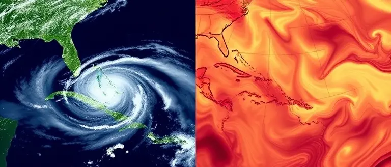
The 2026 Atlantic hurricane season has entered a critical, dual-phase period that demands both immediate tactical preparation and long-term awareness. Residents across the Gulf Coast and South Florida are currently monitoring the development of Tropical Storm Arthur, a system identified by the NOAA hurricane tracking network as having significant potential for intensification as it moves through the Gulf of Mexico. With atmospheric conditions shifting rapidly, meteorologists are warning of potential impacts between June 17 and June 18, 2026, placing emergency preparedness at the forefront of local discourse. This immediate threat is not an isolated incident; it serves as a high-stakes test for the resilience of coastal communities as we enter an unusually volatile summer.
Beyond the immediate tracking of Tropical Storm Arthur, a broader climatological narrative is unfolding: the confirmation of a Super El Niño event. This major climate driver is expected to exert a profound influence on global weather patterns for the remainder of the year. While El Niño cycles traditionally impact wind shear and sea surface temperatures, the “super” designation suggests that 2026 may defy typical seasonal expectations, creating a “wild card” effect for storm formation.
Understanding the Dual-Threat Dynamics
To navigate this season safely, residents must bridge the gap between real-time weather alerts and macro-level climate trends. The interaction between these two factors is defining the current season:
- Tactical Urgency: Tropical Storm Arthur represents a localized, short-term emergency that requires residents to follow local evacuation protocols and emergency management directives immediately.
- Climatological Context: The Super El Niño creates an environment where hurricane intensity can become unpredictable, often leading to rapid intensification that standard models may struggle to capture.
- Preparedness Shift: Moving away from passive observation, households should treat current NOAA data as an active trigger for finalizing storm kits, reviewing insurance policies, and establishing communication plans.
The convergence of these events has naturally led to increased climate anxiety, but the most effective response remains rooted in verifiable data. By prioritizing updates from the National Hurricane Center and maintaining a realistic understanding of how the Super El Niño influences storm behavior, residents can transition from reactive panic to proactive, informed readiness.
Tropical Storm Arthur: Your Immediate Action Checklist

As Tropical Storm Arthur gains strength in the Gulf of Mexico, residents across South Florida must transition from passive observation to active preparation. With landfall projections coalescing around June 17-18, 2026, the window for effective fortification is closing. While meteorological data from the NOAA hurricane center monitors the storm’s intensification, local residents should prioritize self-reliance. Preparation is not merely about tracking the storm’s path; it is about mitigating risk to life and property before conditions deteriorate. If you live in a low-lying or coastal area, act now to ensure your household is ready for potential heavy rainfall, localized flooding, and high winds.
Essential Preparedness Steps
To streamline your response, utilize the following checklist to ensure you are ready before the storm makes its move:
- Secure Outdoor Hazards: Move patio furniture, potted plants, and decorative items indoors. These become dangerous projectiles during high-wind events.
- Verify Emergency Kits: Ensure your stock includes at least one gallon of water per person per day for three days, non-perishable food, a manual can opener, flashlights with extra batteries, and a first-aid kit.
- Identify Evacuation Zones: Visit your county’s official emergency management website to verify your specific evacuation zone. Knowing your zone now prevents panic if authorities issue local orders later.
- Activate Real-Time Alerts: Program your NOAA Weather Radio and enable Wireless Emergency Alerts (WEA) on your smartphone. These devices provide the most reliable warnings for rapid-onset weather developments.
- Document Assets: Take photos of your home’s interior and exterior for insurance purposes before the storm hits. Keep important documents—such as IDs, insurance policies, and medical records—in a waterproof, portable container.
The combination of this immediate weather threat and the ongoing Super El Niño influence necessitates a proactive mindset. Even if Arthur does not reach major hurricane status, the associated tropical moisture can cause severe flash flooding in South Florida. By completing these tasks today, you reduce the physical and mental strain caused by the storm’s arrival, ensuring your household remains safe as the situation evolves.
Decoding the 2026 Super El Niño: What It Means for Intensity

The 2026 Super El Niño has officially reshaped the meteorological landscape, introducing a “wild card” factor into the NOAA hurricane season that standard models struggle to predict. In layman’s terms, an El Niño typically generates vertical wind shear across the Atlantic, which often acts as a speed bump for storm development. However, the “Super” classification—a designation reserved for extreme sea-surface temperature anomalies—disrupts traditional atmospheric circulation in ways that can override these protective barriers. While El Niño usually suppresses storm frequency, the sheer thermal energy trapped in the Pacific and its ripple effects on global trade winds have created an environment where storms like Tropical Storm Arthur can bypass standard climate expectations.
Why This Season Demands Heightened Vigilance
Think of the current climate environment as a high-stakes engine. If you were recording a quick update for social media, your “Did You Know” script would look like this: “Did you know that a Super El Niño acts like a turbocharger for the atmosphere? While we expect shear to tear storms apart, the heat reservoirs in 2026 are so significant that they are creating erratic patches of low-pressure development, making ‘marginally conducive conditions’ feel much more dangerous than the maps suggest.”
Because the system is behaving unpredictably, residents should focus on the following takeaways regarding the current NOAA hurricane outlook:
- Localized Rapid Intensification: Even when conditions appear stable, the Super El Niño can trigger sudden spikes in storm power, leaving less time for emergency warnings.
- Shifting Tracks: Traditional storm corridors are being influenced by altered high-pressure ridges, meaning areas historically considered “safe” must remain alert.
- Beyond the Averages: Do not rely on historical season averages. The “Super” designation means we are operating outside the data points of the last decade, requiring a proactive rather than reactive stance on personal safety.
By translating these technical climate drivers into actionable awareness, we bridge the gap between complex meteorological reporting and the need for urgent community preparedness. Monitor official updates closely as this atypical season unfolds.
NOAA Seasonal Outlook: Indicators to Watch Beyond the Probabilities

When analyzing the NOAA hurricane seasonal outlook, it is easy to become overwhelmed by shifting percentage probabilities. However, for residents in high-risk zones, understanding the environmental “fuel” driving these forecasts is far more valuable than tracking daily numerical changes. The 2026 season, heavily influenced by the emergence of a Super El Niño, presents a unique set of meteorological variables that residents should monitor in official bi-weekly updates. By focusing on these physical indicators, you can better anticipate hurricane development long before a named storm reaches your coastline.
Key Environmental Indicators for 2026
To gauge the real-time threat, look past the headlines and focus on three critical datasets often highlighted in NOAA’s long-range technical discussions:
- Sea Surface Temperatures (SSTs): Hurricanes are heat engines. If NOAA reports abnormally high SSTs in the “Main Development Region” of the Atlantic, the energy available for intensification is elevated. Even in a Super El Niño year, localized hotspots in the Gulf of Mexico can rapidly fuel systems like Tropical Storm Arthur.
- Saharan Air Layer (SAL): This is your best friend during hurricane season. The SAL consists of hot, dry, dusty air blowing off the African coast. When NOAA identifies a strong SAL presence, it acts as a “buffer” that suffocates developing storms. If the SAL is absent or weak, watch for rapid tropical cyclone formation.
- Vertical Wind Shear: This refers to the change in wind speed or direction at different altitudes. High wind shear effectively “rips” apart developing tropical systems. While the Super El Niño generally increases shear, you should watch for local gaps in this pattern, which create “safe zones” where storms can undergo explosive intensification.
By tracking these indicators, you can look beyond the generalized NOAA hurricane outlooks and make informed decisions about your household’s safety. Understanding these stressors empowers you to transition from passive anxiety to active, data-informed emergency preparedness. When these atmospheric conditions align, your emergency kit should be ready, regardless of what the current seasonal probability suggests.
Hardening Your Home Before the Winds Arrive
As we monitor the path of Tropical Storm Arthur and prepare for the broader impacts of the 2026 Super El Niño, it becomes clear that information is only half the battle. While staying updated on official NOAA alerts is vital, the most effective way to manage weather-related anxiety is to take control of your environment. Physical preparedness is the ultimate insurance policy against the uncertainty of the coming months, shifting your focus from the path of the storm to the structural integrity of your own property.
This is where proactive home hardening becomes your greatest asset. Rather than waiting for the next alert, you can begin reinforcing your windows, sheds, and outdoor structures right now. By utilizing professional-grade construction plans, you can turn your home into a fortress capable of weathering the elements. This is why we recommend the comprehensive resources found in Ted’s Woodworking. It acts as the ultimate ‘Home Hardening Toolkit,’ providing you with the exact blueprints needed to secure your property and provide peace of mind for your family.
Don’t leave your home’s safety to chance; access the master library of storm-ready building plans and reinforce your property before Arthur makes landfall. By taking action today, you move from the stress of the ‘what-if’ to the confidence of being prepared.
 Don’t leave your home’s safety to chance; access the master library of storm-ready building plans and reinforce your property before Arthur makes landfall.Secure My Property Now!