

Texas is bracing for a volatile week of severe weather as a potent cold front and dryline collide, setting the stage for significant threats across Houston, Austin, and San Antonio. As of May 19, 2026, meteorologists are sounding the alarm for Tuesday night through Wednesday morning, warning residents of damaging winds, large hail, and the ever-present risk of flash flooding. While radar updates provide a snapshot of the storm’s intensity, the reality for homeowners is a race against time to prepare property for the potential impact that could linger well into the busy Memorial Day weekend.
Beyond simply tracking the forecast, the most critical step you can take right now is shifting your focus from monitoring the sky to securing your environment. With the Houston weather remaining unpredictable, the transition from passive worry to actionable preparation is essential. Whether you are in the heart of the city or in the surrounding regions affected by this system, having a concrete plan to protect your home’s exterior structures is no longer optional—it is a necessity for minimizing damage and ensuring your family’s safety during this multi-day weather event.
Current Houston Weather Alert: Severe Storms and Flash Flood Risk
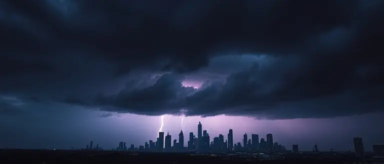
As of May 19, 2026, meteorologists have issued urgent warnings regarding an active, multi-day severe weather pattern sweeping across Texas. The Houston weather outlook indicates a significant escalation in storm intensity, driven by the convergence of a stalled cold front and a dryline pushing through the state. This atmospheric setup is expected to trigger a series of volatile storms starting Tuesday night and extending into Wednesday morning, necessitating heightened vigilance from all residents. While the primary focus is on the Houston metropolitan area, the broader corridor—including Austin weather patterns and the latest weather San Antonio reports—suggests a regional threat level categorized as a “Level 2 out of 5” (moderate) risk for severe convective activity.
Primary Hazards and Regional Timeline
The primary threats associated with this weather system include the potential for damaging winds, large hail, and localized flash flooding. Because the atmosphere is heavily primed with moisture, any slow-moving storm cells could result in rapid, intense rainfall capable of overwhelming drainage systems in low-lying areas. Residents across the I-10 and I-35 corridors should prepare for the following conditions:
- Damaging Winds: Gusts could reach speeds capable of downing power lines and causing localized debris buildup.
- Flash Flooding: Heavy, concentrated rainfall remains the top concern for Tuesday night, specifically for urban zones where water accumulation can trigger dangerous road conditions.
- Large Hail: Meteorologists warn that some cells may develop the strength to produce hail, posing a risk to vehicles and exposed property.
Whether you are tracking weather Houston developments or checking San Antonio weather updates, the consensus is that this event is not a “one and done” storm. The instability is forecasted to linger, complicating outdoor plans and travel logistics heading into the upcoming Memorial Day weekend. It is critical to monitor local radar feeds and follow “Weather Impact Alerts” closely, as the timing of the strongest storms may fluctuate as the front interacts with shifting surface temperatures. Ensure your mobile devices are charged and your emergency alerts are enabled to receive real-time notifications regarding potential watches or warnings.
Houston Severe Storm Safety Checklist

As active, multi-day severe weather impacts the region, prioritizing life-safety over property damage is essential. With weather Houston models indicating a Level 2 out of 5 risk, residents must proactively secure their homes before the atmospheric instability peaks. High-velocity winds and the potential for hail necessitate immediate action to prevent property damage and ensure personal safety during this volatile period.
Securing Your Home and Property
To mitigate damage from incoming storms, focus on fortifying your immediate environment:
- Clear Outdoor Hazards: Secure patio furniture, grills, and decorative items that could become projectiles in high winds.
- Check Drainage Systems: Ensure that gutters and downspouts are free of debris to handle the intense rainfall forecasted for the coming days.
- Emergency Go-Bag: Assemble a kit containing non-perishable food, one gallon of water per person per day, a battery-powered radio, mobile chargers, flashlights, and vital prescription medications.
- Stay Informed: Sign up for local emergency alert systems provided by the city and monitor reputable local news outlets like KHOU 11 or Click2Houston for real-time updates.
Flash Flood Safety and Transit
Navigating Texas weather during severe storm events requires strict adherence to the “Turn Around, Don’t Drown” mantra. Flash flooding is a primary risk in the Houston area, often developing with little notice. If you must travel, avoid low-lying roads and underpasses, which are notorious for rapid water accumulation.
As you monitor austin weather and san antonio weather trends alongside local conditions, remember that conditions can change rapidly. If sirens sound or a Flash Flood Warning is issued, move to higher ground immediately. Never attempt to drive through flooded roadways, as the depth of water is often deceptive and carries enough force to sweep away vehicles. By treating this weather event with a high level of urgency, you significantly decrease the risk of injury and property loss as we head into the Memorial Day weekend.
Memorial Day Weekend Texas Weather Outlook

As the current multi-day severe weather event unfolds across the state, many residents are looking ahead to the Memorial Day weekend Texas weather forecast with growing concern. The combination of a cold front and a persistent dryline has created a high-stakes environment for Houston weather, with potential spillover effects impacting travelers heading toward Austin weather zones and the San Antonio weather corridor. Because these storms are expected to linger, ground saturation levels are reaching a critical threshold. Even if the primary severe weather threat subsides by late week, residents should prepare for significant travel disruptions, particularly on regional highways prone to rapid flash flooding.
Travel and Outdoor Preparedness
The outlook for the holiday weekend remains volatile. Meteorologists indicate that the lingering atmospheric instability may result in pop-up thunderstorms, complicating plans for camping, coastal getaways, or outdoor backyard gatherings. To ensure your holiday remains safe, consider the following utility-focused preparation strategies:
- Prioritize Flexibility: If you have travel plans, monitor traffic apps and local news outlets like KHOU or Click2Houston continuously. Avoid driving through flooded streets, even if the water appears shallow; “Turn Around, Don’t Drown” remains the most vital safety mantra during this period.
- Assess Soil and Ground Conditions: With heavy, sustained rain, local parks and hiking trails may face closures due to mud or standing water. Check park status updates before heading out to popular nature spots.
- Secure Property Early: Given that the forecast indicates storms could have a “bite to them,” use the days leading up to Memorial Day to clear storm drains of debris and secure loose patio furniture or outdoor decor.
- Plan Indoor Alternatives: Given the unpredictable nature of the current weather patterns, having a secondary plan for indoor activities can prevent frustration if outdoor events are cancelled due to severe weather alerts.
While the desire to enjoy the holiday is high, the current meteorological data suggests that the Houston severe storm risk profile requires a cautious approach. Staying informed through hyper-local updates is essential as the region navigates this active weather pattern. By planning for potential delays and keeping a close eye on the latest radar developments, residents can manage the impact of these storms while prioritizing safety.
Stay Informed: Real-Time Tracking and Visual Updates

Monitoring the rapidly evolving houston weather requires more than just checking a static smartphone app. As a multi-day severe weather event impacts Southeast and Central Texas, residents must shift toward active tracking methods to stay ahead of sudden atmospheric changes. Because this storm system is triggered by a cold front and dryline, conditions can deteriorate in minutes. Utilizing high-frequency radar updates allows you to visualize the movement of heavy rainfall and hail, providing a critical lead time that standard alerts simply cannot match.
Leveraging Visual Radar and Social Meteorology
The most effective way to grasp the immediate impact of these weather systems is through visual radar interpretation. Today, local meteorologists are increasingly turning to short-form video platforms like TikTok and Instagram Reels to provide rapid-fire, visual breakdowns of storm cells. Unlike traditional news broadcasts, these social-first updates allow experts to highlight specific neighborhoods in the path of the storm, translating complex meteorological data into actionable insights for your commute or home safety.
To stay ahead of the weather houston cycle and regional trends spanning to austin weather and san antonio weather, integrate these habits into your daily routine:
- Follow Trusted Local Meteorologists: Prioritize feeds from reputable local stations that provide hyper-local radar loops rather than national generic forecasts.
- Enable Push Notifications for Severe Alerts: Ensure your mobile device is set to receive emergency weather warnings from the National Weather Service (NWS) specifically for your zip code.
- Monitor Multi-Day Radar Trends: Look for “first line” storm arrivals to identify when the peak of the intensity will hit your specific area, especially as you plan for the upcoming Memorial Day weekend.
- Cross-Reference Data: Compare radar visuals with live traffic maps to identify flooded roads before you start your drive, preventing the risk of being caught in high-water events.
By prioritizing these visual tools, you transform from a passive observer of the san antonio weather or Houston storms into an informed resident capable of making proactive decisions to protect your property and family during this active pattern.
Fortify Your Sanctuary Before the Next Storm Hits
Staying informed about the current Houston weather is the first step, but as we look toward the potential disruptions of the Memorial Day weekend, passive observation is no longer enough. The real difference between a home that survives the season and one that suffers costly damage lies in your proactive efforts to reinforce your property today. While regional forecasters track the radar, smart homeowners are already focusing on structural resilience.
This is where having the right technical foundation becomes invaluable. Rather than scrambling when winds pick up, you can take control of your home’s defenses by building reliable, storm-ready upgrades. Our recommended toolkit provides the foolproof, workshop-tested blueprints you need to construct everything from reinforced outdoor structures to specialized storage for emergency gear. It is the ultimate insurance policy for your peace of mind, allowing you to transform generic safety advice into tangible, structural reality.
Don’t wait for the next heavy rainfall or damaging wind event to find your home’s weaknesses. Equip yourself with the professional-grade plans that turn DIY resilience into your best line of defense. Take action now to ensure your family and property are ready for whatever Texas weather comes next.
 Download these professional-grade building plans to fortify your home against the upcoming weather impact today.Secure My Property Now!