
When the National Weather Service issues a severe thunderstorm watch, the atmosphere outside your window is signaling a high-stakes potential for danger. With wind gusts intensifying, large hail looming, and tornado threats increasing across the Midwest and Plains, it is easy to feel paralyzed by the barrage of news alerts. However, understanding exactly what this status means—and distinguishing it from a more urgent ‘warning’—is the first step toward reclaiming control over your environment. This is not just a time to monitor the radar; it is a critical window to shift from passive worry to proactive safety.
A ‘watch’ serves as your early warning system, indicating that conditions are favorable for severe weather to develop. While the meteorologists are busy tracking these convective cells, your primary focus should be on personal safety and immediate home preparedness. Moving beyond simple weather tracking, this guide empowers you to understand the meteorological risks and provides actionable steps to fortify your surroundings before the storm arrives. By preparing now, you transform a high-stress weather event into a managed situation for you and your family.
Understanding Today’s Severe Thunderstorm Watch: May 18, 2026
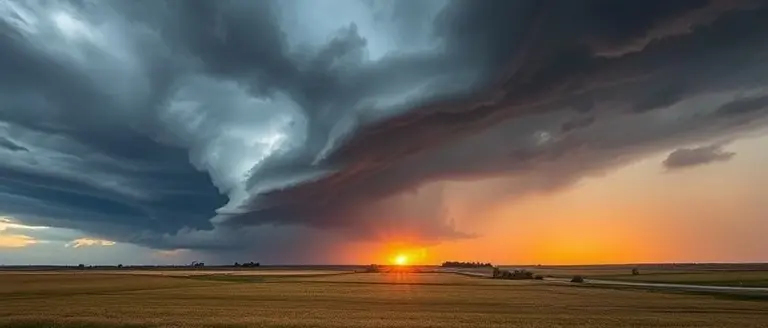
As of May 18, 2026, the National Weather Service (NWS) Storm Prediction Center (SPC) has identified a significant and volatile weather setup impacting the Midwest and Plains regions. A widespread severe thunderstorm watch is currently in effect for large portions of Illinois, Michigan, and adjacent areas, signaling that atmospheric conditions are primed for the development of dangerous convective weather. Residents across these regions should remain vigilant, as the current environment is conducive to the rapid escalation of storms that could pose a threat to life and property.
Meteorological data indicates that the risk profile for this event is multifaceted. Forecasters are highlighting several primary hazards that necessitate immediate attention:
- High-End Wind Gusts: Potential for straight-line winds capable of causing structural damage and downed power lines.
- Large Hail: The potential for significant hail accumulation, which may lead to vehicle and property damage.
- Tornado Risk: Increased atmospheric shear and instability have elevated the possibility of localized tornado activity within the broader storm system.
This is a rapidly evolving situation. The severe thunderstorm watch serves as a proactive notification that the environment is favorable for storm development, but it does not mean that severe weather is occurring at this exact moment in every location. Instead, it is a call to action for residents to monitor local news sources, such as NBC Chicago or regional NWS offices, and to have a reliable way to receive urgent alerts. By staying informed, you can ensure that you are prepared to move to a safe location should a formal severe thunderstorm warning be issued for your specific county. Residents are urged to review their emergency plans and remain weather-aware throughout the duration of this event.
Watch vs. Warning: Knowing the Difference Could Save Your Life

When severe weather strikes, understanding the distinction between a severe thunderstorm watch and a warning is essential for your safety. While both terms signify hazardous weather, they represent entirely different levels of urgency and require distinct actions from you and your family.
A severe thunderstorm watch means that conditions are favorable for the development of severe thunderstorms in or near your area. It does not necessarily mean a storm is happening right now; rather, it indicates that the atmosphere has the potential to produce damaging winds, large hail, or even isolated tornadoes. Think of a “watch” as the time to stay alert and prepare. During a watch, you should monitor local news, review your safety plan, and ensure your mobile devices are charged to receive potential updates.
In contrast, a severe thunderstorm warning is a critical alert indicating that a severe storm is either currently occurring or imminent based on radar data or spotter reports. If you are under a warning, the threat is no longer theoretical—it is happening. At this point, you must stop what you are doing and take immediate protective action.
Essential Safety Guidelines
To stay safe during these volatile weather events, keep the following priorities in mind:
- During a Watch: Remain vigilant and keep your emergency kit nearby. Secure outdoor furniture or items that could become airborne in high winds, and ensure you have multiple ways to receive updated alerts, such as a NOAA weather radio or a reliable weather app.
- During a Warning: Seek shelter immediately. Move to a sturdy building, stay away from windows, and head to a basement or an interior room on the lowest floor. If you are caught outdoors or in a vehicle, move to the nearest substantial structure.
By recognizing the difference between these two alerts, you transform from a passive observer into an active participant in your own safety, ensuring you are never caught unprepared when severe weather threatens your community.
What to Do During a Severe Thunderstorm Watch
When the National Weather Service issues a severe thunderstorm watch, it serves as a critical signal that environmental conditions are primed for the development of dangerous weather, including high-end wind gusts, large hail, and potential tornadoes. While a “watch” indicates that severe weather is possible rather than imminent, taking proactive steps is the most effective way to reduce panic and ensure the safety of your household. Preparedness is your first line of defense against volatile convective systems that can move rapidly through the Midwest and Plains regions.
Immediate Safety Checklist
To stay ahead of developing storms, treat the duration of the watch as a period of heightened readiness. Follow these actionable steps to secure your home and family:
- Secure Outdoor Property: Bring in patio furniture, trash cans, grills, and any lightweight lawn ornaments that could become dangerous projectiles in high winds.
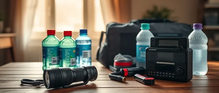
- Power Up: Ensure all mobile devices, portable chargers, and laptops are fully charged. If you have a battery-powered or hand-crank weather radio, place it in a central, accessible location to receive real-time updates even if the power grid fails.
- Designate a Shelter: Identify the safest location in your home, such as a basement, storm cellar, or a windowless interior room on the lowest floor. Clear this area of heavy items that could fall during a storm.
- Stay Informed: Enable emergency alert notifications on your smartphone and monitor local news outlets or official National Weather Service updates. Avoid relying solely on social media, which may contain outdated or unverified reports.
- Plan for Utilities: If the watch escalates to a severe thunderstorm warning, be prepared to stay away from windows and glass doors. Keeping these simple tasks completed allows you to react instantly if a warning is issued for your specific county.
By moving from a state of uncertainty to one of readiness, you significantly decrease the risk associated with rapidly changing weather patterns. Remember that conditions can shift in minutes; keeping your alert systems active ensures you remain aware of the situation until the National Weather Service confirms the threat has passed.
How to Stay Updated in Your Local Area

When a severe thunderstorm watch is active for your region, access to timely and accurate information is your most critical safety tool. During rapidly evolving weather events across the Midwest and Plains, misinformation can spread quickly on social media. To ensure your household remains informed, prioritize official, data-driven sources that provide geo-targeted updates specific to your county.
Rely on Official Meteorological Sources
Avoid relying on hearsay or unverified reports during severe weather. Instead, maintain a direct line to meteorologically sound data:
- National Weather Service (weather.gov): This is the gold standard for real-time alerts. Enter your zip code to view active watches and warnings specific to your exact location.
- Wireless Emergency Alerts (WEA): Ensure your smartphone settings have “Emergency Alerts” enabled. These are location-based pushes that bypass network congestion to deliver life-saving information.
- NOAA Weather Radio: Consider keeping a battery-operated or hand-crank NOAA weather radio in your home. These devices provide continuous broadcasts from the NWS and function even during grid-down scenarios or power outages.
- Local Broadcast Meteorologists: Trusted local news stations often provide crucial “on-the-ground” context, such as localized flooding or specific neighborhood-level storm tracking, which complements the broader scope of NWS alerts.
Understanding Alert Reliability
Distinguishing between a watch and a warning is vital for your immediate response. A watch indicates that conditions are favorable for the development of severe weather, meaning you should monitor your surroundings and stay tuned to updates. Conversely, a warning signifies that a severe storm is occurring or is imminent in your area, necessitating immediate shelter. By configuring your devices to receive push notifications from reputable weather apps or local government alert systems, you ensure that you receive the necessary information to make split-second safety decisions without relying on delayed social media feeds. Always prioritize official warnings over anecdotal reports to keep your family safe during active convective weather events.
Build a More Resilient Home Today
While staying informed during a severe weather event is essential, the reality of climate volatility means that reactive measures are never enough. True peace of mind comes from knowing your home is structurally prepared to handle the intense wind gusts and storm impacts that have become all too common. Your home is your sanctuary, and its ability to withstand the elements depends entirely on the strength of its structural integrity.
This is where proactive fortification becomes your best defense. Instead of hoping for the best when the next watch is issued, you can take control by upgrading your home’s weak points. Whether it is reinforcing your entryway, securing outdoor structures, or building heavy-duty safety gear, having a professional plan is the key to minimizing potential damage. By investing in these improvements now, you effectively transition from the stress of storm-watching to the confidence of home-hardening.
To support your journey toward a more durable living space, we recommend utilizing Ted’s Woodworking. This comprehensive library provides over 16,000 professional-grade blueprints that allow you to build essential safety items and reinforce your property with technical certainty. It is the ultimate toolkit for any homeowner who refuses to be caught off guard when the next front moves in.
 Download your comprehensive library of structural plans now and start building a safer, more storm-resistant home today.Yes, I Want to Secure My Home Now!