

Charlotte is currently caught in a volatile atmospheric transition. Following a weekend of intense wind gusts reaching 40 mph, our region is finally seeing a much-needed soaking from low-hanging clouds and fog. While this moisture is a critical relief for our ongoing Stage 3 drought, the meteorological outlook for Wednesday, April 29, 2026, presents a sharp pivot: as a powerful cold front approaches, the potential for heavier, more destructive storm cells increases significantly. For residents across the Queen City, the conversation has moved from simple rainfall totals to the reality of how our infrastructure—and our individual properties—can withstand this rapid shift from record-dry conditions to sudden, severe weather.
Understanding the “why” behind these events is just as important as monitoring the hourly forecast. The current weather system is testing the limits of our municipal water infrastructure, which has been strained by months of deficit. As we brace for tomorrow’s severe storm threat, it is time to move beyond the daily weather report and prioritize long-term resilience. Staying informed is the first line of defense, but for the modern homeowner, the true test of preparedness begins at the property line.
Charlotte Weather Update: Tracking the April 29th Severe Storm Threat
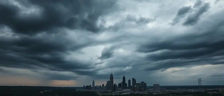
As of April 28, 2026, the charlotte weather pattern is undergoing a significant transition. Following a turbulent weekend characterized by aggressive wind gusts reaching 40 mph and isolated storm activity, the region has shifted into a period of low clouds and pervasive fog. This transition serves as the precursor to a more active meteorological event. While current conditions remain largely stable in terms of precipitation intensity, the atmospheric moisture levels are steadily increasing, signaling the approach of a potent cold front that is expected to impact the Carolinas throughout Wednesday, April 29, 2026.
The Wednesday Severe Storm Outlook
Meteorologists have issued a Weather Impact Alert as this cold front prepares to sweep across the region. Residents should anticipate a rapid shift from the current low-visibility, damp conditions to potentially hazardous weather by early Wednesday. Key concerns regarding the incoming system include:
- Heavy Rainfall: Expected to provide a critical, if rapid, influx of moisture to a region currently struggling under Stage 3 drought conditions.
- Strong Storm Potential: The instability associated with the approaching front increases the risk of convective development, which could result in localized flooding and damaging winds.
- Infrastructure Stress: The sudden transition from dry, drought-stricken soil to heavy saturation may overwhelm local drainage systems, making caution on roadways essential.
The community remains hyper-vigilant, with local discussions on platforms like Reddit highlighting active monitoring of lightning and wind developments. While the precipitation is viewed as a necessary reprieve from the prolonged moisture deficit, the speed and intensity of the cold front dictate a need for heightened preparedness. Residents are encouraged to stay tuned to local alerts, as the severity of the charlotte weather on Wednesday will depend on the timing of the frontal passage and the available instability within the local atmosphere. Ensure all outdoor items are secured tonight to mitigate the risk of damage from potential overnight gusts.
The Drought Relief Factor: Why This Rain Matters

The current charlotte weather pattern represents a critical turning point for the region, which has been grappling with a persistent Stage 3 drought. While meteorologists are monitoring the potential for severe storms ahead of an approaching cold front, the primary focus for local water utility managers and agricultural stakeholders is the accumulation of moisture. Under Stage 3 conditions, the soil has reached a significant moisture deficit, causing the earth to harden and lose its natural absorption capacity. Consequently, when heavy rain arrives rapidly, the ground often acts more like pavement than a sponge, leading to increased surface runoff rather than deep-soil saturation.
Understanding the Hydrological Impact
To move the needle on the current water deficit, the Carolinas require sustained, moderate rainfall rather than short, intense bursts that trigger flash flooding. According to meteorological insights, the efficacy of this rain event depends on several factors:
- Soil Saturation Rates: Persistent dry spells have compacted the local landscape; therefore, initial rainfall often fails to penetrate deep into the root zones of agricultural crops.
- Water Utility Reserves: While this precipitation provides a psychological and environmental reprieve, municipal water systems usually require weeks of consistent, above-average rainfall to see a measurable increase in reservoir levels.
- Runoff vs. Infiltration: The “flashy” nature of these storms means that while local storm drains may reach capacity quickly, the long-term benefit to the regional water table remains limited by the rapid transition from drought to deluge.
Residents should understand that while the rain is vital for local ecological health and fire prevention, it does not immediately negate the need for ongoing water conservation practices. The transition from a prolonged dry period to a severe storm environment necessitates vigilance, as the combination of parched soil and heavy downpours can exacerbate local traffic hazards and infrastructure stress. Balancing the immediate threat of severe wind and lightning with the desperate need for moisture remains the defining challenge for Charlotte throughout this weather event.
Severe Weather Preparedness: A Practical Guide for Residents

As the Charlotte weather forecast shifts toward a more volatile pattern with the arrival of a cold front, residents must transition from a passive observation of the ongoing Stage 3 drought to an active state of severe weather preparedness. Rapid transitions from prolonged dry spells to intense precipitation can overwhelm local drainage systems, leading to flash flooding and hazardous road conditions. To ensure your household remains resilient during the upcoming storm events, prioritize these actionable steps to safeguard your property and loved ones.
Securing Your Home and Property
Before the onset of heavy rain and strong wind gusts, conduct a perimeter check of your residence. Given the recent history of 40 to 50 mph wind gusts in the Carolinas, unsecured outdoor items become dangerous projectiles.
- Clear Debris: Ensure that gutters and storm drains are free of leaves or debris to assist with rapid water runoff.
- Stow Outdoor Items: Bring patio furniture, trash cans, and garden tools indoors or secure them tightly to prevent wind damage.
- Inspect Trees: If you notice large, dead branches near your roofline, prioritize trimming them during dry intervals to prevent structural impact during storms.
Building Your Emergency Readiness
A “First Alert” mindset is essential when tracking incoming severe weather. Being prepared means having a “go-bag” or emergency kit ready before the sirens sound. Your kit should be easily accessible and contain:
- Communication: A battery-powered or hand-crank NOAA weather radio to stay informed if the power grid fails.
- Essentials: A three-day supply of water, non-perishable food, flashlights with extra batteries, and a comprehensive first-aid kit.
- Documentation: Digital or physical copies of critical personal documents stored in a waterproof container.
- Shelter Protocol: Identify the safest location in your home, typically an interior room on the lowest level, away from windows and glass doors.
If you are on the road when severe storms arrive, avoid driving through standing water, as the depth is often deceptive. By proactively managing your environment, you contribute to the overall safety of the Charlotte community while navigating these critical weather transitions.
Monitoring Long-Term Moisture Deficits in the Carolinas

While immediate charlotte weather updates focus on the high-impact storms moving through the region this week, climatologists are closely monitoring a more persistent threat: a long-term moisture deficit that has anchored the Carolinas in a Stage 3 drought. This categorization is not merely a temporary dry spell; it signifies a systemic reduction in groundwater levels and soil moisture saturation that has developed over several months. The current precipitation event, while potentially severe, acts as a double-edged sword for the regional hydrologic cycle. Because the ground remains hardened by prolonged dry conditions, rapid, heavy rainfall often leads to increased runoff rather than deep soil penetration, limiting the immediate relief provided to the local water table.
Understanding Regional Weather Instability
The pattern of alternating high wind gusts and sudden convective storms reflects a broader trend of weather instability impacting the Southeast this spring. Meteorological evidence suggests that the jet stream’s current configuration is facilitating frequent, high-energy systems that collide with the lingering regional drought. Residents should note several critical factors influencing this long-term trend:
- Hydrologic Lag: Soil and aquifer recovery from a Stage 3 drought requires sustained, soaking rainfall rather than high-intensity, short-duration storm events.
- Infrastructure Stress: Rapid transitions from extreme dryness to heavy rain test municipal drainage capacities, as baked soil struggles to absorb water, increasing localized flooding risks.
- Climatological Shifts: The Southeast is experiencing a notable increase in the frequency of “flash-drought” cycles, where rapid evaporation rates accelerate the decline of moisture levels during warm months.
Ultimately, while the rain arriving through April 29, 2026, is essential for mitigating agricultural and municipal water stress, it does not immediately resolve the systemic deficit. Climatologists emphasize that tracking long-term moisture trends is vital for urban planning in Charlotte, as the city must balance the urgent need for replenishment against the increasing necessity for severe weather infrastructure upgrades to manage sudden, high-volume runoff.
Fortify Your Home Against the New Climate Reality
As we navigate the current cycle of drought-breaking rain and looming severe storms, it becomes clear that Charlotte’s weather patterns are shifting. While staying informed through local alerts is a vital first step, awareness alone cannot protect your property from the increasing frequency of high-wind events and heavy, destructive precipitation. True safety lies in moving beyond passive observation and taking active, preventative steps to reinforce the structural integrity of your home environment before the next system hits.
This is where the transition from concern to capability is most critical. Whether it is reinforcing outdoor structures, hardening entry points, or securing property against wind-driven debris, having a professional-grade technical approach is essential. Instead of waiting for contractors or hoping for the best, you can empower yourself with the right knowledge and tools to ensure your home remains a sanctuary regardless of what the radar indicates.
We highly recommend Ted’s Woodworking as your ultimate resilience toolset. By providing 16,000 professional blueprints, this resource bridges the gap between weather awareness and structural preparedness, allowing you to perform high-quality fortifications on your own terms and timeline. It is the practical, solutions-based investment every Charlotte homeowner needs to secure their property against the volatile climate.
 Build your home’s resilience against the next storm—access 16,000 professional blueprints for durable, storm-ready property improvements today.Secure My Home & Build Resilience Now!