
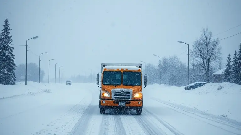
As we push through late April 2026, the arrival of a heavy snow warning across the Western and Upper Midwestern United States serves as a jarring reminder that spring remains on nature’s terms, not ours. From the Rockies of Colorado and Wyoming to the northern reaches of Montana and Minnesota, a violent collision between stubborn arctic air fronts and the warming spring atmosphere is delivering a dangerous mix of record-breaking snowfall—projected up to 20 inches in some areas—and hurricane-force winds reaching 75 mph. For residents in these regions, the situation is immediate: travel is becoming hazardous, power outages are a genuine risk, and the sudden freeze threatens the fragile early growth of spring landscapes.
This isn’t your typical April shower; this is a high-stakes weather event that demands more than just checking a forecast. Beyond the immediate safety protocols of hunkering down and staying off the roads, homeowners are now facing the dual challenge of protecting their property from ice damage and managing the mental strain of being unexpectedly housebound by mid-spring blizzards. Preparing for this surge of snow requires a pivot from standard routines to focused, actionable safety strategies that keep your home secure and your family comfortable while the landscape outside transforms into a winter battleground.
The Late-April Arctic Plunge: Tracking the Heavy Snow Warnings

As of April 26, 2026, a severe meteorological event has gripped large swaths of the American West and Upper Midwest, prompting a widespread heavy snow warning which states are now scrambling to manage. This disruption is the result of a volatile collision between a powerful, descending arctic air mass and the unseasonably warm spring temperatures that had previously settled across the region. This atmospheric clash has transformed standard spring showers into intense, high-impact winter storms, catching many residents off guard as they transition into late-season agricultural and travel routines.
The impact zones are extensive, with the most significant hazards concentrated in the high-elevation areas of Colorado, Wyoming, and Montana, as well as the Great Lakes region, particularly affecting Duluth, Minnesota. Meteorologists are tracking the following critical conditions:
- Snowfall Accumulations: Forecasts suggest a heavy blanket of 12 to 20 inches of snow in the most severely impacted corridors, creating significant challenges for local infrastructure.
- High-Velocity Winds: Wind gusts are reaching staggering speeds of up to 75 mph, which are exacerbating whiteout conditions and increasing the risk of power outages and fallen trees.
- Travel Safety: The rapid accumulation of snow combined with low visibility has rendered many mountain passes and regional highways treacherous, leading authorities to issue strict travel advisories.
The severity of this event serves as a stark reminder of the unpredictability inherent in late-April weather patterns. By analyzing the trajectory of this arctic front, experts note that the intensity of the precipitation is driven by the stark temperature gradient between the encroaching cold air and the moisture-rich air characteristic of the spring season. Residents in the affected states should treat these warnings as immediate directives for safety, as the current conditions far exceed typical late-April fluctuations. Keeping updated on county-level alerts remains the most effective way to navigate this sudden and dangerous shift in seasonal climate.
Real-Time Travel Safety: Navigating Sudden Spring Blizzards
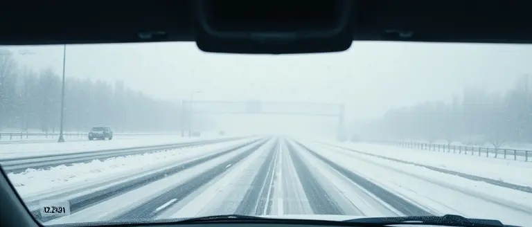
When a heavy snow warning which states that conditions are deteriorating, the primary danger for motorists often lies in the “false spring” mindset. After weeks of milder temperatures, many drivers have already transitioned their vehicles to summer tires or have grown complacent regarding road surface hazards. In states like Colorado, Wyoming, Montana, and Minnesota, these late-season storms create a deceptive environment where rapid temperature drops turn melting precipitation into invisible black ice. The collision of arctic fronts with warmer spring air creates extreme instability, often leading to whiteout conditions that reduce visibility to near zero within minutes. If you must travel, checking your state’s Department of Transportation (DOT) website for real-time road closures is non-negotiable.
Essential Safety Protocols and Emergency Preparedness
If you encounter hazardous weather, prioritize maintaining a significant following distance and avoiding cruise control, which can cause hydroplaning or loss of traction on slushy surfaces. To ensure you are prepared for unexpected delays caused by the current heavy snow warning, your vehicle should be equipped with a robust emergency kit.
- Traction and Visibility: Keep an ice scraper, snow brush, and a small bag of sand or cat litter to improve tire grip if you become stuck in snow drifts.
- Emergency Kit Essentials: Pack high-energy non-perishable snacks, extra heavy blankets, a portable phone charger, and a battery-powered flashlight with spare batteries.
- Safety Gear: Carry high-visibility clothing or reflective vests in case you need to exit your vehicle on a busy highway shoulder.
- Fluid Levels: Ensure your gas tank remains at least half-full to prevent fuel line freeze-ups and provide heat if you are stranded for an extended duration.
Monitoring local meteorologist social media feeds provides more granular, real-time safety data than general weather outlets, helping you anticipate high-wind corridors where gusts up to 75 mph may threaten high-profile vehicles. When official advisories are issued, the safest strategy remains staying off the roads entirely until local authorities confirm that plow crews have cleared primary transit routes.
Protecting Your Spring Garden: Survival Tips for Late-Season Freezes

When a heavy snow warning which states that arctic air is colliding with spring-like conditions, the immediate impact is often felt most acutely by residential landscapes. Late-season snowfalls in states like Colorado, Wyoming, Montana, and Minnesota can be devastating to new growth that has already emerged during the warmer days of early April. To prevent permanent tissue damage or crop loss, gardeners must take swift, proactive measures to insulate their greenery against plummeting temperatures and heavy, wet snowfall.
Essential Frost Mitigation Techniques
If you are currently under a heavy snow warning, prioritize these steps to safeguard your perennials, early vegetables, and budding shrubs:
- Implement Layered Mulching: Apply a thick layer of organic mulch, such as straw or shredded bark, around the base of plants. This acts as an insulator, preventing the soil from flash-freezing and protecting the root systems of delicate flowers.
- Utilize Frost Cloths and Covers: Cover vulnerable beds with burlap, canvas, or specialized frost blankets. Ensure the fabric reaches the ground to trap the heat radiating from the soil. Avoid using plastic directly on plant leaves, as it can cause localized freeze damage.
- Relocate Container Plants: Any potted plants or hanging baskets should be moved into a garage, shed, or basement. Even a non-heated interior space is significantly safer than remaining exposed to 75 mph wind gusts and sub-freezing precipitation.
- Hydrate Before the Freeze: Moist soil retains heat better than dry, parched soil. If the ground is not yet frozen, water your garden thoroughly ahead of the arctic front to create a thermal buffer.
Beyond these tactical steps, avoid the urge to shake heavy snow off brittle, frozen branches. Ice-laden stems are highly susceptible to snapping; instead, allow the snow to melt naturally unless it poses a structural threat to your larger garden infrastructure. By treating this late-season freeze as an immediate emergency, you can minimize the impact of these extreme weather patterns on your backyard ecosystem.
Understanding the Meteorological Phenomenon: Why April Snow Strikes
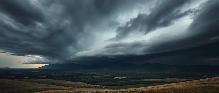
The recent heavy snow warning which states that late-season winter weather is capable of severe disruption highlights a complex atmospheric interaction known as an “arctic collision.” As we navigate late April, the Western and Upper Midwestern United States are witnessing a clash between retreating arctic air masses and the warming, moisture-rich air characteristic of the spring season. This thermal transition creates intense instability; when high-pressure systems from the north force cold air into areas where ground temperatures have already begun to rise, the resulting lift can produce rapidly intensifying low-pressure systems. These storms are particularly hazardous because they frequently evolve into high-wind events, with gusts reaching up to 75 mph, which compound the danger of heavy, wet snowfall accumulations of 12-20 inches.
The Dynamics of Unpredictable Spring Weather
Meteorological evidence suggests that these late-season spikes are becoming increasingly volatile as seasonal weather patterns shift. Homeowners in states like Colorado, Wyoming, Montana, and Minnesota should be aware of the specific challenges posed by these occurrences:
- Weight Accumulation: Unlike mid-winter snow, late-April snow is often dense and heavy, placing immense stress on trees that have already begun to bud or leaf out.
- Flash Freezing: Sudden drops in temperature following precipitation can lead to rapid icing on roadways, creating dangerous travel conditions long after the primary storm has passed.
- Hydrological Stress: The rapid transition from snow to melt can cause localized flooding if drainage systems are still blocked by winter debris or frozen soil.
As these “arctic collisions” become more frequent, residents must move away from the assumption that spring arrival is linear. Preparing for sudden freezes is now a critical component of home management in the Midwest and West. Whether it is protecting early-season crops with thermal blankets or ensuring gutters are clear for incoming meltwater, the current climate reality demands a proactive, rather than reactive, approach to April weather safety. By monitoring localized forecasts from regional meteorologists rather than relying on general outlets, residents can better navigate the transitionary volatility of the American spring.
Transform Your Storm-Bound Downtime into Peak Productivity
As the storm rages outside and you remain safely tucked away, the temptation to succumb to cabin fever is real. However, the most resilient homeowners know that extreme weather provides an unexpected opportunity to reclaim their time and invest in the long-term value of their properties. Rather than worrying about the howling winds, you can turn this period of forced confinement into a constructive, creative outlet that prepares your home for the seasons ahead.
While you wait for the storm to pass and prioritize your home’s safety, why not tackle those interior repairs or structural projects you’ve been putting off? This is where Ted’s Woodworking becomes your ultimate ‘Storm-Ready Productivity Tool.’ By providing access to a massive, professional-grade library of blueprints and project guides, this platform allows you to transform stagnant, snowed-in hours into tangible home improvements. It is the perfect solution for anyone looking to master their environment and gain the skills to build, repair, and upgrade their living space, effectively turning a period of confinement into a highly productive experience.
This is the most efficient way to maximize your time while the weather remains uncooperative. By investing in these expert plans now, you aren’t just passing the time; you are building a better home. Don’t let these hours go to waste when they could be the foundation for your next great DIY success.
 Access the comprehensive library of blueprints today to turn your home’s downtime into a finished, professional-grade project.Start My Building Projects Today!