
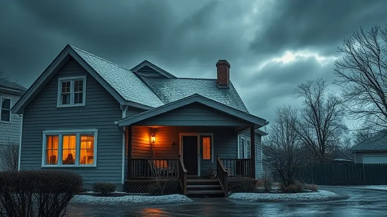
The violent outbreaks of severe weather sweeping across the Midwest and Southern United States this late April 2026 have served as a sobering reminder of our atmospheric vulnerability. With millions of residents under urgent NWS alerts for high-risk tornado potential, destructive wind, and hail, the conversation around meteorological safety is no longer just about tracking storms—it is about understanding the systemic shifts in climate volatility driving these events. From the anomalous Omega Block patterns disrupting global norms to the rapid-fire intensity of this spring’s outbreaks, the frequency of these extreme events is prompting a critical re-evaluation of how we prepare our families and our properties for the next surge.
While staying informed through meteorology reports is vital, the true transition from panic to preparedness occurs at the intersection of information and physical home-hardening. It is one thing to monitor a storm’s path, but it is another to know your home is structurally equipped to withstand the onslaught. In the following sections, we will move past the news headlines to focus on evergreen safety infrastructure, providing you with a roadmap to assess your vulnerabilities and execute the necessary upgrades to turn your property into a reliable shelter for those you love.
Understanding the April 2026 Severe Weather Pattern: A Meteorological Overview
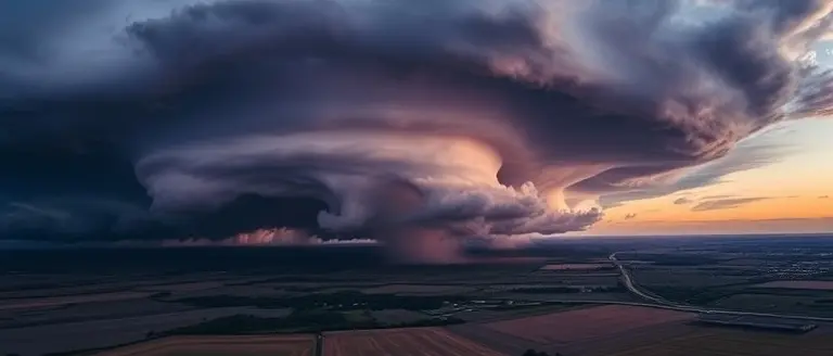
The severe weather outbreak that impacted the United States between April 24 and April 27, 2026, represents a significant period of atmospheric instability, following closely on the heels of the intense tornado activity recorded earlier in the month. Meteorological analysis indicates that this surge in activity was driven by a classic, yet exceptionally potent, collision of air masses. A strong trough of low pressure pushed deep into the central United States, drawing warm, moist air from the Gulf of Mexico northward into the Midwest and Southern regions. This moisture-rich environment provided the essential “fuel” for supercell development, while strong wind shear—the change in wind speed and direction with height—allowed these storms to organize into long-lived, rotating systems capable of producing destructive tornadoes, large hail, and damaging wind gusts.
Beyond regional dynamics, experts are looking at global teleconnections that may have contributed to this sustained volatility. Atmospheric scientists have noted the presence of an anomalous “Omega Block” over Europe throughout this period. In an Omega Block, a high-pressure system becomes “stuck” between two low-pressure systems, resembling the Greek letter Omega. This configuration forces the jet stream into extreme, meandering patterns across the Northern Hemisphere. Evidence suggests that these shifts in the polar jet stream have ripple effects on North American weather, trapping troughs in place and prolonging the period over which states remain under threat of storm systems.
Key factors contributing to the high frequency of these events include:
- Persistent Moisture Transport: Continued advection of Gulf moisture provided consistent CAPE (Convective Available Potential Energy) levels, necessary for sustaining high-intensity storms over multiple days.
- Jet Stream Meanderings: The broader hemispheric pattern, potentially influenced by the European Omega Block, led to a “stalled” synoptic pattern that focused the brunt of the storm activity over the same vulnerable regions.
- Atmospheric Volatility: The rapid transition from spring-like warming to deep troughs has exacerbated the instability, leading to the high-frequency events observed throughout April 2026.
This environment highlights the importance of staying informed through official National Weather Service (NWS) channels, as the atmospheric setup currently favors rapid storm development and significant hazardous weather coverage across the US.
Is Climate Volatility Increasing? Analyzing Spring Storm Trends

The frequency and intensity of severe weather events during the spring of 2026 have prompted significant scientific scrutiny regarding long-term atmospheric trends. Over the past decade, climatologists have observed a marked increase in the volatility of spring storm patterns across the United States. While year-to-year variability is a natural component of the Earth’s climate system, current data suggests that the baseline for atmospheric instability is shifting. This trend is characterized by more frequent, high-impact outbreaks—such as the consecutive events seen in April 2026—rather than a steady, predictable distribution of storms throughout the season.
Shifting Risk Zones and Atmospheric Instability
Evidence suggests that changes in large-scale circulation patterns are directly impacting the severity of weather events. The scientific consensus points toward a complex interplay between warmer global temperatures and moisture transport from the Gulf of Mexico. These factors increase CAPE (Convective Available Potential Energy), providing the necessary fuel for explosive supercell development. Key trends observed by meteorological experts include:
- Geographic Expansion: There is a noticeable migration of tornado-prone regions, with an increased frequency of destructive storms occurring further east and north of the traditional “Tornado Alley,” putting larger populations at risk.
- Atmospheric Blocking: Persistent, slow-moving pressure systems, such as the Omega Block seen in global models, can trap weather patterns in place. This leads to prolonged periods of either extreme heat or, conversely, unseasonal Arctic air intrusions that collide with warm, moist air to trigger violent storm outbreaks.
- Intensity Volatility: Modern datasets indicate that while the total number of storms may not always increase, the “clustering” effect—where multiple severe cells form in rapid succession over several days—is becoming more prevalent, straining local emergency infrastructure.
As we analyze these trends, it becomes clear that the interaction between changing climate variables and regional topography is creating a more volatile environment. Understanding these shifts is essential for long-term preparedness, as families and policymakers alike must adapt to a “new normal” where the margin for error during severe weather events has significantly narrowed.
NWS Alert Literacy: Understanding Risk Levels and Safety Actions

Navigating the complexities of severe weather requires more than just monitoring the sky; it demands a precise understanding of the National Weather Service (NWS) communication framework. For residents across the Midwest and Southern United States, the distinction between a “Watch” and a “Warning” is often the difference between adequate preparation and a life-threatening crisis. The NWS utilizes a tiered alert system designed to convey the urgency and proximity of atmospheric threats, such as the high-risk conditions observed during the late April 2026 tornado outbreaks.
Deciphering the NWS Alert Tiers
- Severe Thunderstorm or Tornado Watch: This indicates that conditions are favorable for the development of severe weather. Think of this as a “be prepared” state. The atmosphere is unstable, and the ingredients for storm formation are present in the region. During a Watch, you should review your emergency plan, ensure your mobile devices are charged, and stay tuned to local broadcasts or a NOAA Weather Radio.
- Severe Thunderstorm or Tornado Warning: This is an immediate, life-safety alert. A Warning signifies that severe weather has been detected by Doppler radar or spotted by trained weather observers on the ground. A tornado or damaging wind event is occurring or is imminent in your specific location. You must seek shelter immediately.
Critical Safety Actions for Immediate Response
When a Warning is issued, speed and location are your greatest allies. If you are under a Tornado Warning, move to a pre-designated “safe room” or an interior room on the lowest floor of your home, such as a basement, storm cellar, or a windowless bathroom. Avoid mobile homes, vehicles, and areas with wide-span roofs, as these structures offer minimal protection against high-intensity winds. If you are caught outdoors or in a vehicle, do not attempt to outrun the storm; prioritize reaching the nearest sturdy building. By mastering these alert protocols, you can transform panic into organized, lifesaving action, ensuring your family remains protected during periods of extreme meteorological volatility. Always treat an NWS Warning as a non-negotiable directive to take cover, regardless of whether you personally perceive an immediate threat.
Building a Reliable Emergency Infrastructure for Your Home
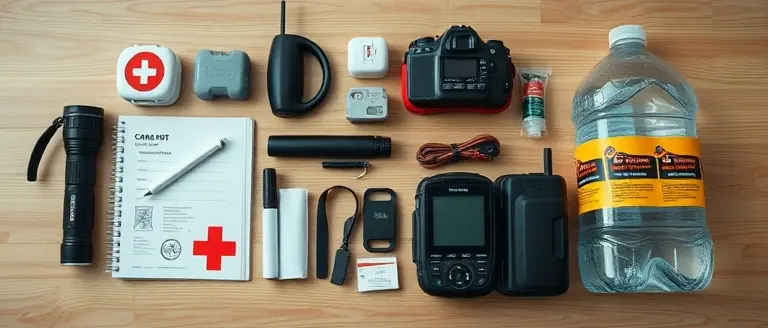
Given the increased frequency of severe weather across the Midwest and Southern regions this spring, establishing a robust home safety infrastructure is no longer optional—it is a necessity for family survival. According to guidelines provided by FEMA and the NOAA, preparedness begins with a self-sufficient emergency kit that sustains your household for at least 72 hours. Your kit should be housed in a waterproof, portable container and include one gallon of water per person per day, a three-day supply of non-perishable food, a battery-powered or hand-crank NOAA Weather Radio, and a comprehensive first-aid kit. Furthermore, digital and physical copies of vital documents—such as insurance policies, identification, and medical records—must be stored in a sealed, fireproof, and waterproof bag to ensure quick retrieval during an urgent evacuation.
Strategic Safety and Communication Planning
Beyond physical supplies, your household must develop an actionable family communication plan. This plan should designate a primary out-of-state contact person whom all family members can reach if local cellular networks are congested during or after a storm. Ensure every family member knows exactly where to shelter; in the event of a tornado, this must be an interior, windowless room on the lowest level of your home, ideally a basement or a reinforced storm cellar.
To reinforce your home’s structural resilience against high-velocity wind gusts and large hail:
- Install storm shutters or pre-cut plywood covers for all windows to mitigate glass breakage.
- Secure loose outdoor items like patio furniture, grills, and decorative lawn ornaments that can become dangerous projectiles during extreme wind events.
- Maintain surrounding vegetation by trimming overhanging tree limbs that could damage roofs or power lines.
- Utilize surge protectors for sensitive electronics to prevent damage from power fluctuations often triggered by lightning strikes.
By shifting from reactive panic to proactive, infrastructure-based preparedness, you significantly increase your household’s safety margin when volatile weather patterns threaten your community. Regularly audit your supplies and conduct drills to ensure that, when a warning is issued, your household can transition into survival mode with immediate, practiced efficiency.
Taking Action: Building Your Home’s First Line of Defense
As the volatility of our climate becomes an increasingly undeniable reality, shifting your mindset from reactive worry to proactive preparation is the most empowering step you can take. While receiving NWS alerts is essential for immediate safety, long-term security requires physical investment in the structural integrity of your home. By reinforcing your environment, you move from being a victim of the next storm to a guardian of your family’s safety.
This is where physical preparedness meets professional craftsmanship. Rather than waiting for the next weather event to test your home’s weaknesses, you can use Ted’s Woodworking as your ultimate safety infrastructure toolbox. Whether you need to construct heavy-duty, storm-resistant window shutters or build secure, reinforced storage to protect your critical emergency supplies from wind and debris, having access to high-quality, professional-grade blueprints is the bridge between uncertainty and resilience.
Investing in these DIY projects allows you to take physical control of your property’s defenses. It is a practical, effective way to harden your home, ensuring you have the protective installations necessary to withstand destructive gusts and unpredictable weather. Your safety starts with the steps you take today, turning your living space into a fortress capable of enduring the challenges of a volatile climate.
 Download these verified DIY blueprints to start building your home’s emergency defenses today.Secure My Home with These Blueprints!